Page 2 of Maps & Globes
(121 Products)
Sort by:
Best match

National Geographic Antarctica Satellite Map, Laminated, 31.25" x 20.25" (NGMRE00620144)
Item #: 901-24611405
National Geographic Antarctica Satellite Wall Map has a striking view of Antarctica's terrain, compiled from 4,500 satellite scans
Additional inset maps show surface elevation, ice sheet thickness, velocity of ice flow, and sea ice movement and windflow.
The map is encapsulated in heavy-duty 1.6 mil laminate which makes the paper much more durable and resistant to the swelling and shrinking caused by changes in humidity.
$25.99
Per each


National Geographic United States Decorator Map, Laminated, 43.5" x 30.5" (NGMRE00622083)
Item #: 901-24611382
National Geographic's Decorator style map of the United States features rich, attractive color fills that bring any room or classroom to life.
Measures 43.5" x 30.5"
Colorful Decorator style map with vibrant color palette that fills each country for easy identification
$34.29
Per each
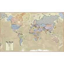
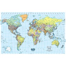
Hemispheres® Boardroom Series World Laminated Wall Map, 38" x 61" (RWPHM03)
Item #: 901-24519762
Modern antique decorative style
Up-to-date cartography and points of interest
Includes countries, capitals, major cities and more
$33.99
Per each


National Geographic Earth's Moon Map, Laminated, 42.5" x 28.5" (NGMRE00620137)
Item #: 901-24611437
National Geographic's "The Earth's Moon" is like having an atlas and almanac in one.
This incredibly informative wall map features detailed depictions of the entire surface of the moon with a selective index showing the named physical features.
Diagrams show the moon's orbital paths, rotation around Earth, librations, how solar and lunar eclipses occur, how the moon affects Earth's tides, and more.
$38.19
Per each
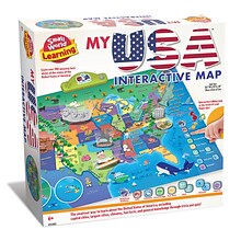
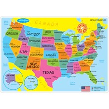
Small World Toys My USA Interactive Map, 30.7" x 24" (SWT9721053)
Item #: 901-24519539
Great learning and educational toy
Interactive talking map
Great way for children to learn the USA map while playing
$54.19
Per each


National Geographic Continental Divide Trail Map, In Gift Box, 18" x 48" (NGMRE01021204X)
Item #: 901-24611457
National Geographic Continental Divide Trail Wall Map- National Geographic's map of the Continental Divide Trail is ideal for fans and hikers of this magnificent National Scenic Trail.
Measures 18" x 48"
It makes a great planning tool or as reference to track progress on the 3,100 plus mile length.
$20.79
Per each


National Geographic World and United States Executive, Poster Size, Map Pack Bundle, 36" x 24" (NGMRE01021232B)
Item #: 901-24611443
National Geographic's World and United States maps are the standard by which all other reference maps are measured.
Measures 36" x 24"
Antique-style "executive" color palette
$30.99
Per set


National Geographic The Milky Way Map, Laminated, 31.25" x 20.25" (NGMRE00620140)
Item #: 901-24611410
This computer-generated image of the Milky Way shows the entire galaxy in one perspective of a 3-D model compiled specially for National Geographic.
The model incorporates the positions of hundreds of thousands of stars and nebulae within the galaxy, shows Earth's location.
Includes additional photographs, descriptions and locations of fascinating phenomena throughout the Milky Way.
$33.69
Per each


National Geographic Appalachian Trail Map, Laminated, 18" x 48" (NGMRE01020743)
Item #: 901-24611441
Expertly researched and designed, National Geographic's map of the Appalachian Trail is ideal for fans and hikers of this magnificent national scenic trail.
Measures 18" x 48"
It makes a great planning tool or as reference to track progress on the 2,200 mile length.
$30.99
Per each
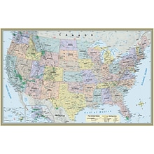
U.S. Map Laminated Poster, 50" x 32" (QS-9781423220817)
Item #: 901-159318
US Map
32" x 50"
Great for all ages
$13.49
Per each


National Geographic Night Sky, Stargazer folded Map Pack Bundle, Folded: 4.25" x 9.25" ; Flat: 25.25" x 18.5" (NGMRE01021310B)
Item #: 901-24611374
National Geographic's The Night Sky - Stargazer Map Pack the Northern Hemisphere is centered on Polaris, the North Star, the Southern Hemisphere is centered near Crux, the Southern Cross.
Measures 4.25" x 9.25" folded and 25.25" x 18.5" flat
As the Earth moves in its orbit around the Sun the constellations in the sky change. The Night Sky maps include four seasonal charts that are specific for each season.
$25.99
Per set


National Geographic World Classic Map, Laminated, 43.5" x 30.5" (NGMRE00622002)
Item #: 901-24611430
Expertly researched and designed, National Geographic's World Wall Map is the authoritative map of the world by which other reference maps are measured.
Measures 43.5" x 30.5"
Signature Classic style map with bright, easy to read color palette with blue oceans and colorful borders
$32.89
Per each
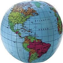
Learning Resources Inflatable Globe, 12"
Item #: 901-JV34271
Age group and grade: Ages 5 - 13
Size: 12"(Dia)
Includes a repair kit and an activity guide
$8.99
Per each
House of Doolittle Laminated World Map, 38" x 25" (HOD711)
Item #: 901-JV158531
Classroom World and U.S.A Map
Size: 25"(H) x 38"(W)
Material(s): Recycled Paper/Polyethylene
$31.19
Per each


National Geographic World Executive Map, Enlarged and Laminated, 73" x 48" (NGMRE00622088)
Item #: 901-24611311
Expertly researched and designed, National Geographic's World Wall Map is the authoritative map of the world by which other reference maps are measured.
Measures 73" x 48"
Antique-style "executive" color palette
$70.99
Per each


National Geographic The Universe Map, Laminated, 31.25" x 20.25" (NGMRE00620139)
Item #: 901-24611384
National Geographic's Universe Wall Map, shows as far as we can see with our ever-improving telescope, at least a hundred billion galaxies arrayed throughout the universe.
This map uses graphic leaps of scales to show how our solar system fits within the vastness of the universe.
The map also includes a universe timeline and a description of its evolution.
$32.89
Per each


National Geographic National Parks & National Forest of the US, Map Pack Bundle (NGMDM01021301B)
Item #: 901-24611388
National Geographic's Destination Maps of National Forests and Grasslands of the United States highlights the 154 national forests and 20 national grasslands across America.
A list of all forest service and grasslands units, sorted by region, is also included to help you find the closest recreational opportunity.
The National Park and National Forest Map Pack Includes: National Parks of the United States & National Forests and Grasslands of the United States
$29.69
Per set


National Geographic United States Executive Map, Poster Size and Laminated, 36" x 24" (NGMRE01020388)
Item #: 901-24611390
National Geographic's United States wall map is the standard by which other reference maps of the U.S. are measured.
The 36" x 24" poster size supports easy and affordable framing and mounting, and takes less wall space than standard wall maps.
Antique-style "executive" color palette
$30.99
Per each


National Geographic World and United States Coloring, Map Pack Bundle, 36" x 24" (NGMRE01021221B)
Item #: 901-24611425
National Geographic's cartographers adapted our World and United States for Kids Maps to black and white outline versions that you can color.
Measures 36" x 24"
The World and United States Coloring Maps include country and state flags that can all be colored along with a bonus full color letter size sheets that has all of the flags.
$21.59
Per set
Ashley Productions Smart Poly™ Learning Mats, 12" x 17", Double-Sided, U.S. Basic Map, Pack of 10 (ASH95600)
Item #: 901-24389608
Water Resistant
Colorful designs on both sides
Measures 12" x 17", pack of 10 learning mats
$48.89
Per pack


National Geographic World Classic Map, Poster Size and Laminated, 36" x 24" (NGMRE01020381)
Item #: 901-24611380
Expertly researched and designed, National Geographic's World Wall Map is the authoritative map of the world by which other reference maps are measured.
The 36" x 24" poster size supports easy and affordable framing and mounting, and takes less wall space than standard wall maps.
Signature Classic style map with bright, easy to read color palette with blue oceans and colorful borders
$32.89
Per each


National Geographic Road Atlas 2024: Adventure Edition, United States, Canada, Mexico, 11" x 15" (NGMRD00620166)
Item #: 901-24611369
National Geographic's Road Atlas: Adventure Edition, is the ideal companion for the next time you hit the road.
Setting this atlas apart from all other road atlases are the inclusion of detailed maps and guidebook-like recommendations on the top 100 destinations for adventure.
Includes up-to-date road maps for all 50 U.S. States, plus Canada, Mexico, and Puerto Rico. Major cities and metropolitan areas are shown in detail with inset maps that include popular attractions.
$33.39
Per each


National Geographic World Physical Map, Enlarged and Laminated, 69.25" x 46.25" (NGMRE00620133)
Item #: 901-24611445
Expertly researched and designed, National Geographic's The Physical World map highlights the Earth's land and undersea forms with exquisite hand-painted relief.
Two corner inset maps show the Earth's crust and world climatic zones.
Enlarged maps provide an immersive experience in any home or office environment. The exceptional cartography is even easier to appreciate at the larger size
$75.39
Per each


National Geographic World and United States Classic, Poster Size, Map Pack Bundle, 36" x 24" (NGMRE01021231B)
Item #: 901-24611427
National Geographic's World and United States maps are the standard by which all other reference maps are measured.
Measures 36" x 24"
The signature Classic style maps use a bright, easy to read color palette featuring blue oceans and stunning shaded relief that has been featured on National Geographic wall maps for over 75 years.
$30.99
Per set

