


We're sorry, this item is no longer available Choose an alternative
Product details
Reviews
Age
Brand
Kids Theme
Number of Pieces
Number of Puzzle Pieces
Pack Qty
Puzzle Type
Length in Inches
Material of Item
Width in Inches
Item no longer available

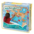
Item # 901-JV37348
Youth
Educational Insights
Other
54
1-100
1
Chunky Puzzle
24
Foam
36
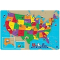

Shop Maps & Globes
(112 Products)
Sort by:
Best match


Item #:901-24611428
$27.99
Per each


Item #:901-24611392
$63.99
Per each


Item #:901-24611382
$37.79
Per each


Item #:901-24611374
$25.99
Per set


Item #:901-24611371
$24.29
Per each


Item #:901-24611431
$32.69
Per each


Item #:901-24611415
$24.29
Per each


Item #:901-24611430
$36.19
Per each


Item #:901-24611443
$30.99
Per set


Item #:901-24611317
$27.99
Per each

Item #:901-JV62863
5
(1)
$129.19
Per each

Item #:901-JV158524
2.4
(5)
$29.39
Per each


Item #:901-24611311
$63.99
Per each


Item #:901-24611366
$24.29
Per each


Item #:901-24611410
$24.29
Per each

Item #:901-24451753
$255.19
Per each

Item #:901-JV158533
4.5
(8)
$50.39
Per each


Item #:901-24611369
$36.79
Per each


Item #:901-24611413
$36.19
Per each


Item #:901-24611454
$36.99
Per set


Item #:901-24611398
$147.19
Per each


