We're sorry, this item is no longer available Choose an alternative
Product details
Reviews
Age Range
Age Set
Brand
Continental Coverage
Diameter in Inches
Geographic Region
Height in Inches
Laminated
Map & Globe Type
Material of Item
Pack Qty
Series or Collection
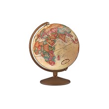
Item no longer available

Item # 901-JV1111413
N/A
N/A
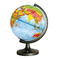
Elenco
N/A
N/A
N/A
N/A
N/A
N/A
N/A
N/A
N/A
5+ years
N/A
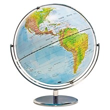
Replogle Globes
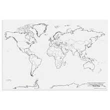
World
12
World
17
Not Laminated
Globes
Plastic
1
Pioneer
More alternatives
$87.19
each
5+ years
5+ years
Replogle Globes
World
N/A
World
17
Not Laminated
Globes
Plastic
1
N/A
N/A
5+ years
Replogle Globes
World
12
World
N/A
Not Laminated
Globes
Plastic
1
Treasury

N/A
5+ years
National Geographic
World
12
World
N/A
Not Laminated
Globes
Plastic
1
N/A
Shop Maps & Globes
(112 Products)
Sort by:
Best match
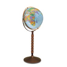
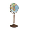
Replogle Globes Treasury Floor Model Globe, 12" (RE-30803)
Item #: 901-JV62863
Classroom World Globe
Size(s): 12" diameter
Material(s): Plastic, Wood, Metal


National Geographic Appalachian Trail Map, In Gift Box, 18" x 48" (NGMRE01020716X)
Item #: 901-24611439
Expertly researched and designed, National Geographic's map of the Appalachian Trail is ideal for fans and hikers of this magnificent national scenic trail.
Measures 18" x 48"
It makes a great planning tool or as reference to track progress on the 2,200 mile length.
Hemispheres® Boardroom Series World Laminated Wall Map, 38" x 61" (RWPHM03)
Item #: 901-24519762
Modern antique decorative style
Up-to-date cartography and points of interest
Includes countries, capitals, major cities and more
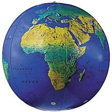
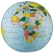
Replogle Globes Inflatable Topographical Globe, 12"(Dia), 2 Ea
Item #: 901-932907
Age group and grade: Ages all and grades all
Subject: Social studies
Globe features: Physical map styling, inflatable


National Geographic Space, Stargazer folded Map Pack Bundle, Folded: 4.25" x 9.25" ; Flat: 25.25" x 18.5" (NGMRE01021309B)
Item #: 901-24611454
National Geographic's Stargazer Map and Guides Map Pack Bundle of Space includes maps that get progressively further from Earth on four waterproof tear-resistant maps.
Measures 4.25" x 9.25" folded and 25.25" x 18.5" flat
Each Stargazer Map and Guide shows detailed maps and graphics to help locate features on the moon, planets, and stars.


National Geographic Appalachian Trail Map, Laminated, 18" x 48" (NGMRE01020743)
Item #: 901-24611441
Expertly researched and designed, National Geographic's map of the Appalachian Trail is ideal for fans and hikers of this magnificent national scenic trail.
Measures 18" x 48"
It makes a great planning tool or as reference to track progress on the 2,200 mile length.


National Geographic United States Classic Map, Laminated, 43.5" x 30.5" (NGMRE00620411)
Item #: 901-24611428
National Geographic's United States wall map is the standard by which other reference maps of the U.S. are measured
Measures 43.5" x 30.5"
Signature Classic styling with bright, easy to read color palette with blue water and colorful state borders. All 50 states with insets for Hawaiian Islands and Alaska
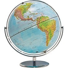
Advantus® 12" Political World Globe, Blue Oceans
Item #: 901-AVT30502
World globe
Each globe has a diameter of 12"
Globe with raised relief and a full swing meridian


National Geographic World Classic Map, Enlarged and Laminated, 69.25" x 48" (NGMRE00622003)
Item #: 901-24611409
Expertly researched and designed, National Geographic's World Wall Map is the authoritative map of the world by which other reference maps are measured.
Measures 69.25" x 48"
Signature Classic style map with bright, easy to read color palette with blue oceans and colorful borders


National Geographic Continental Divide Trail Map, In Gift Box, 18" x 48" (NGMRE01021204X)
Item #: 901-24611457
National Geographic Continental Divide Trail Wall Map- National Geographic's map of the Continental Divide Trail is ideal for fans and hikers of this magnificent National Scenic Trail.
Measures 18" x 48"
It makes a great planning tool or as reference to track progress on the 3,100 plus mile length.


National Geographic United States Classic Map, Poster Size and Laminated, 36" x 24" (NGMRE01020385)
Item #: 901-24611423
National Geographic United States Wall Map is expertly researched and designed, National Geographic's United States wall map is the standard by which other reference maps of the U.S. are measured.
The 36" x 24" poster size supports easy and affordable framing and mounting, and takes less wall space than standard wall maps.
Antique-style "executive" color palette


National Geographic World Decorator Map, Enlarged and Laminated, 73" x 48" (NGMRE00622080)
Item #: 901-24611320
Expertly researched and designed, National Geographic's World Wall Map is the authoritative map of the world by which other reference maps are measured.
Measures 73" x 48"
Colorful Decorator style map with vibrant color palette that fills each country for easy identification


National Geographic United States Decorator Map, Enlarged and Laminated, 43.5" x 30.5" (NGMRE00622084)
Item #: 901-24611365
National Geographic's Decorator style map of the United States features rich, attractive color fills that bring any room or classroom to life.
Measures 43.5" x 30.5"
Colorful Decorator style map with vibrant color palette that fills each country for easy identification
Pacon® Corporation® Learning Walls® World Map (PAC78770)
Item #: 901-JV38298
Subject: Science/technology, nonfiction
Dimensions: 48" x 72"
A place for students and teachers to interact creatively
Replogle Globe Political Inflate-A-Globe, Light Blue, 12", 2/Bundle
Item #: 901-883184
Style: Political
Size: 12"(Dia)
Introduce children to geography with this inflatable globe, available in a variety of sizes and styles, each globe is brilliantly colored and extremely durable


National Geographic The Heavens Map, Laminated, 30.5" x 22.75" (NGMRE00620136)
Item #: 901-24611415
National Geographic's The Heavens shows star charts and constellations for both the Northern and Southern Hemispheres.
All 2,844 of the stars on the chart, plus nebulae and star clusters, can be seen with the unaided eye, making this chart a perfect companion for viewing the night sky.
They inspire great works of art, and tempt our imaginations into creating stories and myths from the shapes we see.
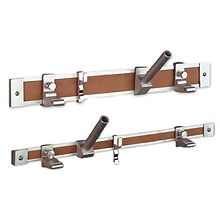
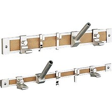
Ghent® Maprail Flag Holder, 1", 2 EA/BD
Item #: 901-877757
Add lots of capability to the rail
Grades: All
Age: All


National Geographic The Universe Map, Laminated, 31.25" x 20.25" (NGMRE00620139)
Item #: 901-24611384
National Geographic's Universe Wall Map, shows as far as we can see with our ever-improving telescope, at least a hundred billion galaxies arrayed throughout the universe.
This map uses graphic leaps of scales to show how our solar system fits within the vastness of the universe.
The map also includes a universe timeline and a description of its evolution.
Replogle Globes The Franklin Globe 12", 1 Globe (RE-31501)
Item #: 901-JV2323238
Classroom World Globe
Size(s): 12" diameter
Material(s): Plastic


National Geographic Triple Crown of Hiking Map, In Gift Box, 18 x 48" (NGMRE01021207X)
Item #: 901-24611421
National Geographic Triple Crown of Hiking Wall Map shows the Appalachian Trail at 2,200 miles, the Pacific Crest Trail at 2,700 miles and the Continental Divide Trail at 3,100 miles.
Measures 18 x 48"
The Triple Crown of Hiking includes these three iconic trails in a decorative gift box that is perfect for the hiker in your life.
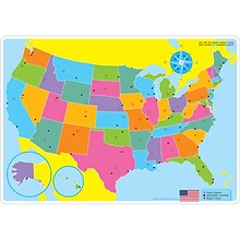
Ashley Productions Smart Poly™ Learning Mats, 12" x 17", Double-Sided, U.S. Basic Map, Pack of 10 (ASH95600)
Item #: 901-24389608
Water Resistant
Colorful designs on both sides
Measures 12" x 17", pack of 10 learning mats


National Geographic Continental Divide Trail Map, Laminated, 18" x 48" (NGMRE01021203)
Item #: 901-24611371
National Geographic Continental Divide Trail Wall Map- National Geographic's map of the Continental Divide Trail is ideal for fans and hikers of this magnificent National Scenic Trail.
Measures 18" x 48"
It makes a great planning tool or as reference to track progress on the 3,100 plus mile length.


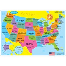
National Geographic United States for Kids Map, Laminated, 24" x 36" (NGMRE01021159)
Item #: 901-24611434
Expertly researched and designed, National Geographic's The United States for Kids wall map is an enticing and engaging United States map perfect for classroom, home or library.
Measures 24" x 36"
Recommended by geography educators for ages 7–12, this map features an optimized map design for readability and easy, intuitive learning.


National Geographic World Classic Map, Laminated, 43.5" x 30.5" (NGMRE00622002)
Item #: 901-24611430
Expertly researched and designed, National Geographic's World Wall Map is the authoritative map of the world by which other reference maps are measured.
Measures 43.5" x 30.5"
Signature Classic style map with bright, easy to read color palette with blue oceans and colorful borders


