
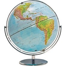
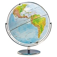
We're sorry, this item is no longer available Choose an alternative
Product details
Reviews
Brand
Item no longer available

Item # 901-JV60361
Kappa Map Group
Shop Maps & Globes
(112 Products)
Sort by:
Best match


National Geographic United States Classic Map, Enlarged and Laminated, 69.25" x 48" (NGMRE00602987)
Item #: 901-24611392
National Geographic's United States wall map is the standard by which other reference maps of the U.S. are measured
Signature Classic styling with bright, easy to read color palette with blue water and colorful state borders. All 50 states with insets for Hawaiian Islands and Alaska
Enlarged maps provide an immersive experience in any home or office environment. The exceptional cartography is even easier to appreciate at the larger size


National Geographic United States Classic Map, Poster Size and Laminated, 36" x 24" (NGMRE01020385)
Item #: 901-24611423
National Geographic United States Wall Map is expertly researched and designed, National Geographic's United States wall map is the standard by which other reference maps of the U.S. are measured.
The 36" x 24" poster size supports easy and affordable framing and mounting, and takes less wall space than standard wall maps.
Antique-style "executive" color palette
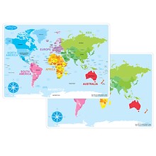
Ashley Productions Smart Poly 12" x 17" World Basic Map Learning Mat, Double-Sided (ASH95002)
Item #: 901-24529536
Heavy duty double-sided surface, no lamination required
Use with dry erase or water based markers and washable crayons
Water Resistant


National Geographic National Parks of the United States Map, Laminated, 42" x 30" (NGMRE01020602)
Item #: 901-24611394
Expertly researched and designed, National Geographic's wall map of National Parks of the United States highlights the nearly 400 magnificent parks across America.
Measures 42" x 30"
The country is represented in subtle earth-tones with shaded mountain relief and intricately drawn river systems.

Teacher Created Resources Map Charts Set 9 Charts, 22" x 17" (TCR9689)
Item #: 901-JV24063211
Map Charts
22" x 17"
5+


National Geographic The Dynamic Earth, Plate Tectonics Map, Laminated, 36" x 24" (NGMRE01020634)
Item #: 901-24611386
National Geographic Dynamic Earth, Plate Tectonics Wall Map illustrates plate tectonics & features stunning bathymetry & naturally colored relief, as well as volcano and earthquake data through 2011.
Measures 36" x 24"
The Dynamic Earth map illustrates 17 major tectonic plates and highlights diffuse plate boundaries, convergent boundaries, spreading boundaries, fault zones, hot spots, and more.


National Geographic Pacific Crest Trail Map, In Gift Box, 18" x 48" (NGMRE01020758X)
Item #: 901-24611433
Expertly researched and designed, National Geographic's map of the Pacific Crest Trail is ideal for fans and hikers of this magnificent National Scenic Trail.
Measures 18" x 48"
It makes a great planning tool or as reference to track progress on the 2,600 plus mile length.
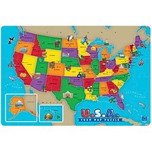
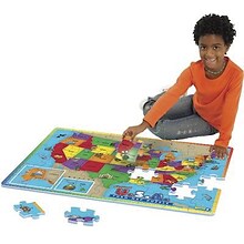
Educational Insights Foam Map Puzzles, USA
Item #: 901-JV37188
Age group and grade: Ages 5 - 7 and grades kindergarten+
Theme/design: Map
Material: Beech wood


Waypoint Geographic World/USA Laminated Notebook Maps, 32/Pack (RWPNB03)
Item #: 901-24610195
Makes easy reference for continents, countries, states and major World and USA cities and other points of interest. Laminated
World on one side, USA on the other
Set includes 32 notebook maps measuring 8.5" x 11"
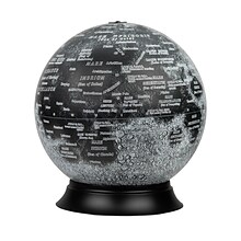
National Geographic Illuminated Moon Globe, 12" Diameter (RE-83522)
Item #: 901-24439128
Illuminated Moon Globe
Globe Size: 12" Diameter
Material: Vinyl, Plastic


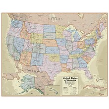
National Geographic United States Decorator Map, Enlarged and Laminated, 43.5" x 30.5" (NGMRE00622084)
Item #: 901-24611365
National Geographic's Decorator style map of the United States features rich, attractive color fills that bring any room or classroom to life.
Measures 43.5" x 30.5"
Colorful Decorator style map with vibrant color palette that fills each country for easy identification
Hemispheres® Boardroom Series United States Laminated Wall Map, 38" x 48" (RWPHM04)
Item #: 901-24519761
Modern antique decorative style
Up-to-date cartography and points of interest
Includes states, capitals and more

National Geographic Australia Classic Map, Laminated, 30.25" x 27" (NGMRE00620146)
Item #: 901-24611407
Expertly researched and designed, National Geographic's Australia Wall Map is the authoritative map of Asia by which other reference maps are measured.
Signature Classic style map with bright, easy to read color palette with blue oceans and colorful borders
Clearly defined international boundaries, cities, islands, airports, and physical features


National Geographic World and United States for Kids, Poster Size, Map Pack Bundle, 36" x 24" (NGMRE01021233B)
Item #: 901-24611447
National Geographic's The World for Kids and United State for Kids wall maps are enticing and engaging world and United States maps perfect for classroom, home or library.
Measures 36" x 24"
Recommended by geography educators for ages 7–12, these maps feature an optimized map design for readability and easy, intuitive learning.
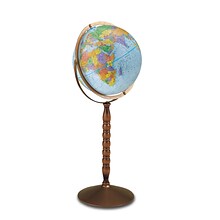
Replogle Globes Treasury Floor Model Globe, 12" (RE-30803)
Item #: 901-JV62863
Classroom World Globe
Size(s): 12" diameter
Material(s): Plastic, Wood, Metal


National Geographic World Physical Map, Laminated, 45.75" x 30.5" (NGMRE00620132)
Item #: 901-24611413
Expertly researched and designed, National Geographic's The Physical World map highlights the Earth's land and undersea forms with exquisite hand-painted relief.
Two corner inset maps show the Earth's crust and world climatic zones.
Drawn in the Winkel Tripel projection, distortions are minimized and unlike many other World maps, Greenland is show the same size as Argentina and not as the size of all of South America.
Advantus® 12" Political World Globe, Blue Oceans
Item #: 901-AVT30502
World globe
Each globe has a diameter of 12"
Globe with raised relief and a full swing meridian
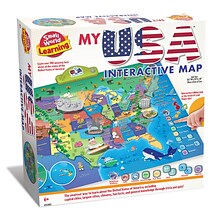
Small World Toys My USA Interactive Map, 30.7" x 24" (SWT9721053)
Item #: 901-24519539
Great learning and educational toy
Interactive talking map
Great way for children to learn the USA map while playing


National Geographic The Americas Classic Map, Laminated (NGMRE00620152)
Item #: 901-24611431
Expertly researched and designed, National Geographic's The Americas Wall Map is the authoritative map of Europe by which other reference maps are measured.
Measures 23.75" x 36.5"
Signature Classic style map with bright, easy to read color palette with blue oceans and colorful borders


National Geographic World Executive Map, Laminated, 46" x 30.5" (NGMRE00622087)
Item #: 901-24611366
Expertly researched and designed, National Geographic's World Wall Map is the authoritative map of the world by which other reference maps are measured.
Measures 46" x 30.5"
Antique-style "executive" color palette

Waypoint Geographic 4" Diameter Blue Ocean GyroGlobe, Pack of 2 (RWPWP50200-2)
Item #: 901-24515200
4" Compact mini globe
Features swivel and tilt multi-directional motion allowing the globe to easily rotate in all directions
Distinguished by it's multi-color styling which makes learning about and identifying locations easy!


National Geographic The Milky Way Map, Laminated, 31.25" x 20.25" (NGMRE00620140)
Item #: 901-24611410
This computer-generated image of the Milky Way shows the entire galaxy in one perspective of a 3-D model compiled specially for National Geographic.
The model incorporates the positions of hundreds of thousands of stars and nebulae within the galaxy, shows Earth's location.
Includes additional photographs, descriptions and locations of fascinating phenomena throughout the Milky Way.

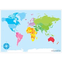
Ashley Productions Smart Poly™ Learning Mats, 12" x 17", Double-Sided, World Basic Map, Pack of 10 (ASH95602)
Item #: 901-24389567
Water Resistant
Colorful designs on both sides
Measures 12" x 17", pack of 10 learning mats
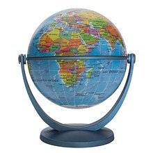
Pioneer Globe
Item #: 901-JV38114
Bright gold finish on numbered full meridian
Map color: Blue
Base material: Plastic


