We're sorry, this item is no longer available Choose an alternative
Product details
Reviews
Brand
Item no longer available
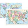
Item # 901-JV60360
Kappa Map Group
Shop Maps & Globes
(113 Products)
Sort by:
Best match
Pacon® Corporation® Learning Walls® US Map (PAC78760)
Item #: 901-JV38297
Subject: Social studies
Subject: Science/technology, nonfiction
Dimensions: 48" x 72"
National Geographic Road Atlas 2024: Adventure Edition, United States, Canada, Mexico, 11" x 15" (NGMRD00620166)
Item #: 901-24611369
National Geographic's Road Atlas: Adventure Edition, is the ideal companion for the next time you hit the road.
Setting this atlas apart from all other road atlases are the inclusion of detailed maps and guidebook-like recommendations on the top 100 destinations for adventure.
Includes up-to-date road maps for all 50 U.S. States, plus Canada, Mexico, and Puerto Rico. Major cities and metropolitan areas are shown in detail with inset maps that include popular attractions.
Small World Toys My USA Interactive Map, 30.7" x 24" (SWT9721053)
Item #: 901-24519539
Great learning and educational toy
Interactive talking map
Great way for children to learn the USA map while playing
National Geographic Maps® Asia Classic, Laminated
Item #: 901-JV62401
Subject: Social studies
Subject: Science/technology, nonfiction
Dimensions: 34" x 38"
National Geographic World Executive Map, Mural, 110" x 76.5" (NGMRE00620092)
Item #: 901-24611398
National Geographic World Wall Map Executive is expertly researched and designed, National Geographic's World Wall Map is the authoritative map of the world by which other reference maps are measured.
Antique-style "executive" color palette
Thousands of place names carefully and artfully placed to maintain legibility in heavily populated areas
National Geographic The Americas Classic Map, Laminated (NGMRE00620152)
Item #: 901-24611431
Expertly researched and designed, National Geographic's The Americas Wall Map is the authoritative map of Europe by which other reference maps are measured.
Measures 23.75" x 36.5"
Signature Classic style map with bright, easy to read color palette with blue oceans and colorful borders
Waypoint Geographic 4" Diameter Blue Ocean GyroGlobe, Pack of 2 (RWPWP50200-2)
Item #: 901-24515200
4" Compact mini globe
Features swivel and tilt multi-directional motion allowing the globe to easily rotate in all directions
Distinguished by it's multi-color styling which makes learning about and identifying locations easy!
National Geographic United States Classic Map, Enlarged and Laminated, 69.25" x 48" (NGMRE00602987)
Item #: 901-24611392
National Geographic's United States wall map is the standard by which other reference maps of the U.S. are measured
Signature Classic styling with bright, easy to read color palette with blue water and colorful state borders. All 50 states with insets for Hawaiian Islands and Alaska
Enlarged maps provide an immersive experience in any home or office environment. The exceptional cartography is even easier to appreciate at the larger size
National Geographic World Classic Wall Map, Mural, 110" x 76.5" (NGMRE00622007)
Item #: 901-JV62402
Mural World Map
Size(s): 110" x 76.5"
Material(s): Laminated Paper
National Geographic World Decorator Map, Enlarged and Laminated, 73" x 48" (NGMRE00622080)
Item #: 901-24611320
Expertly researched and designed, National Geographic's World Wall Map is the authoritative map of the world by which other reference maps are measured.
Measures 73" x 48"
Colorful Decorator style map with vibrant color palette that fills each country for easy identification
National Geographic Continental Divide Trail Map, Laminated, 18" x 48" (NGMRE01021203)
Item #: 901-24611371
National Geographic Continental Divide Trail Wall Map- National Geographic's map of the Continental Divide Trail is ideal for fans and hikers of this magnificent National Scenic Trail.
Measures 18" x 48"
It makes a great planning tool or as reference to track progress on the 3,100 plus mile length.
Replogle Globes Adventurer 12" Political Globe (RE-37500)
Item #: 901-JV59626
Classroom World Globe
Size(s): 12" diameter
Material(s): Plastic
Waypoint Geographic World/USA Laminated Notebook Maps, 32/Pack (RWPNB03)
Item #: 901-24610195
Makes easy reference for continents, countries, states and major World and USA cities and other points of interest. Laminated
World on one side, USA on the other
Set includes 32 notebook maps measuring 8.5" x 11"
Pacon Learning Walls®, United States Map, 48 x 72"
Item #: 901-837594SSW
Place for students and teachers to interact creatively
With Learning Walls children have fun decorating the detailed scenes while learning
Dimensions: 48"(L) x 72"(W)
Hemispheres Blue Ocean Series World & USA Laminated Wall Maps, 2-Pack (RWPHMB02PK)
Item #: 901-JV1112500
Classroom U.S.A & World Map
Size(s): 38" x 51" World, 38" x 48" USA
Material(s): Laminated Paper
National Geographic Earth's Moon Map, Laminated, 42.5" x 28.5" (NGMRE00620137)
Item #: 901-24611437
National Geographic's "The Earth's Moon" is like having an atlas and almanac in one.
This incredibly informative wall map features detailed depictions of the entire surface of the moon with a selective index showing the named physical features.
Diagrams show the moon's orbital paths, rotation around Earth, librations, how solar and lunar eclipses occur, how the moon affects Earth's tides, and more.
House of Doolittle Laminated World Map, 38" x 25" (HOD711)
Item #: 901-JV158531
Classroom World and U.S.A Map
Size: 25"(H) x 38"(W)
Material(s): Recycled Paper/Polyethylene
National Geographic World Executive Map, Poster Size and Laminated, 36" x 24" (NGMRE01020376)
Item #: 901-24611378
Expertly researched and designed, National Geographic's World Wall Map is the authoritative map of the world by which other reference maps are measured.
The 36" x 24" poster size supports easy and affordable framing and mounting, and takes less wall space than standard wall maps.
Antique-style "executive" color palette
Teacher Created Resources Europe Map Chart, 17"W x 22"H (TCR7654)
Item #: 901-JV47411
Theme/design: Social studies
Color: Assorted
Age group and grade: Ages 5 - 11 and grades 1st - 5th
Round World Junior Kid's USA PlaceMap (RWPKPM02)
Item #: 901-24529215
Printed on tested safe sturdy material
Easy to wipe and clean with a damp cloth
Make meal time, fun time!
United States Map Learning Chart
Item #: 901-JV46183
Theme/design: Classroom
Color: Assorted
Size: 17"(H) x 22"(W)
Hemispheres® World Wall Chart with Interactive App, Laminated, 32" x 51.5" (RWPWC05)
Item #: 901-24519540
Colorful laminated wall map
Interactive with 1000's of facts
Free app included
Shapes Etc Practice Map, Unlabeled, 8x16", US
Item #: 901-JV52638
Age group and grade: Ages all and grades all
Subject: Map skills
Multi use notepad is an excellent learning tool
Replogle Globe Political Inflate-A-Globe, Light Blue, 16", 2/Bundle
Item #: 901-880408
Style: Political
Size: 16"(Dia)
Introduce children to geography with this inflatable globe, available in a variety of sizes and styles, each globe is brilliantly colored and extremely durable
