
Sort by:
Best match
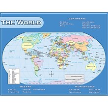
Teacher Created Resources® World Map Chart
Item #: 901-JV47415
Theme/design: Social studies
Color: Assorted
Size: 17"(H) x 22"(W)

Teacher Created Resources Map Charts Set 9 Charts, 22" x 17" (TCR9689)
Item #: 901-JV24063211
Map Charts
22" x 17"
5+
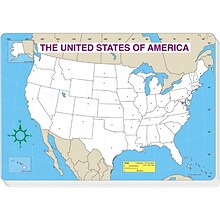
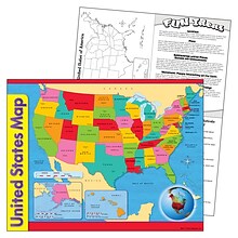
Jumbo Map Pads, U.S. Map, Blank
Item #: 901-JV40309
Subject: Social studies
Subject: Science/technology, nonfiction
Perfect for testing geography knowledge! 30 sheets per pad(15 7/8" x 10 3/4" each) with all the states left blank for testing
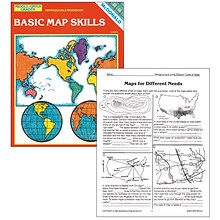
Basic Map Skills Reproducible Book, Grades 6–9
Item #: 901-JV44761
Age group and grade: Ages 9 - teens and grades 6th - 9th
Exercises focus on compass roses, latitude and longitude, time zones, landforms, types of maps and more
Author: Laurie Gilbert and Pat Biggs
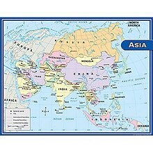
Teacher Created Resources Asia Map Chart, 17"W x 22"H (TCR7652)
Item #: 901-JV47409
Theme/design: Social studies
Color: Assorted
Age group and grade: Ages 5 - 9 and grades 1st - 3rd


National Geographic World and United States for Kids, Poster Size, Map Pack Bundle, 36" x 24" (NGMRE01021233B)
Item #: 901-24611447
National Geographic's The World for Kids and United State for Kids wall maps are enticing and engaging world and United States maps perfect for classroom, home or library.
Measures 36" x 24"
Recommended by geography educators for ages 7–12, these maps feature an optimized map design for readability and easy, intuitive learning.
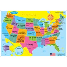
Ashley Productions Smart Poly 12" x 17" U.S. Basic Map Learning Mat, Double-Sided (ASH95000)
Item #: 901-24529551
Heavy duty double-sided surface, no lamination required
Use with dry erase or water based markers and washable crayons
Water Resistant
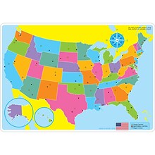
Round World Junior Kid's USA PlaceMap (RWPKPM02)
Item #: 901-24529215
Printed on tested safe sturdy material
Easy to wipe and clean with a damp cloth
Make meal time, fun time!
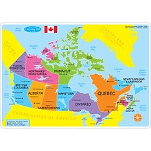
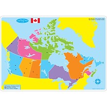
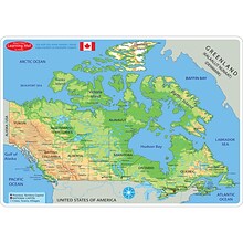
Ashley Productions Smart Poly 12" x 17" Canada Basic Map Learning Mat, Double-Sided (ASH95004)
Item #: 901-24529001
Heavy duty double-sided surface, no lamination required
Use with dry erase or water based markers and washable crayons
Water Resistant
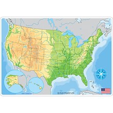
Ashley Productions Smart Poly 12" x 17" U.S. Physical Map Learning Mat, Double-Sided (ASH95001)
Item #: 901-24529533
Heavy duty double-sided surface, no lamination required
Use with dry erase or water based markers and washable crayons
Water Resistant
Hemispheres® World Wall Chart with Interactive App, Laminated, 32" x 51.5" (RWPWC05)
Item #: 901-24519540
Colorful laminated wall map
Interactive with 1000's of facts
Free app included


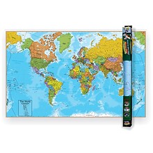
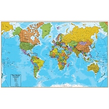
National Geographic World Decorator Map, Laminated, 46" x 30.5" (NGMRE00622079)
Item #: 901-24611317
Expertly researched and designed, National Geographic's World Wall Map is the authoritative map of the world by which other reference maps are measured.
Measures 46" x 30.5"
Colorful Decorator style map with vibrant color palette that fills each country for easy identification
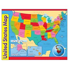
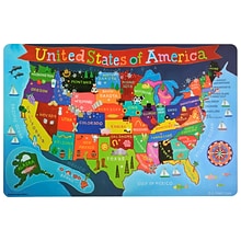
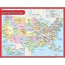
United States Map Learning Chart
Item #: 901-JV46183
Theme/design: Classroom
Color: Assorted
Size: 17"(H) x 22"(W)


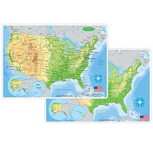
National Geographic Road Atlas 2024: Adventure Edition, United States, Canada, Mexico, 11" x 15" (NGMRD00620166)
Item #: 901-24611369
National Geographic's Road Atlas: Adventure Edition, is the ideal companion for the next time you hit the road.
Setting this atlas apart from all other road atlases are the inclusion of detailed maps and guidebook-like recommendations on the top 100 destinations for adventure.
Includes up-to-date road maps for all 50 U.S. States, plus Canada, Mexico, and Puerto Rico. Major cities and metropolitan areas are shown in detail with inset maps that include popular attractions.


Waypoint Geographic World/USA Laminated Notebook Maps, 12/Pack (RWPNB02)
Item #: 901-24610186
Makes easy reference for continents, countries, states and major World and USA cities and other points of interest. Laminated
World on one side, USA on the other
Set includes 12 notebook maps measuring 8.5" x 11" and a 12 count clip strip


National Geographic Appalachian Trail Map, Laminated, 18" x 48" (NGMRE01020743)
Item #: 901-24611441
Expertly researched and designed, National Geographic's map of the Appalachian Trail is ideal for fans and hikers of this magnificent national scenic trail.
Measures 18" x 48"
It makes a great planning tool or as reference to track progress on the 2,200 mile length.
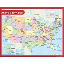
Teacher Created Resources US Map Chart, 17"W x 22"H, 10/Bundle (TCR7657)
Item #: 901-879555
Theme/design: Social studies
Color: Assorted
Size: 17"(H) x 22"(W)
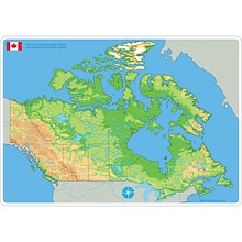
Ashley Productions Smart Poly 12" x 17" Physical Canada Map Learning Mat, Double-Sided (ASH95024)
Item #: 901-24529474
Heavy duty double-sided surface, no lamination required
Use with dry erase or water based markers and washable crayons
Water Resistant
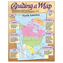
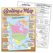
Reading a Map Learning Chart
Item #: 901-JV46162
Theme/design: Classroom
Color: Assorted
Size: 17"(H) x 22"(W)
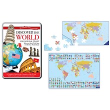
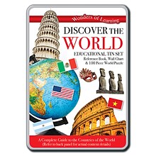
Round World Products Wonders of Learning Tin Set, Discover the World, 2 Sets (RWPTS05BN)
Item #: 901-24391647
Build 2 World 96 piece puzzles
2 Large wall maps of the World
For ages 6+ years
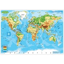
Ashley Productions Smart Poly 12" x 17" World Physical Map Learning Mat, Double-Sided (ASH95003)
Item #: 901-24529521
Heavy duty double-sided surface, no lamination required
Use with dry erase or water based markers and washable crayons
Water Resistant

