We're sorry, this item is no longer available Choose an alternative
Product details
Reviews
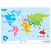
Continental Coverage
Geographic Region
Laminated
Map & Globe Type
Adjustable
Age Range
Brand
Diameter in Inches
Flag Representation
Flag Size
Flag Theme
Flag Type
Height in Inches
Indoor or Outdoor Use
Length (ft.)
Length in Inches
Material of Item
Pack Qty
Width (ft.)
Width in Inches
Item no longer available

Item # 901-138394
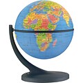
World
World
Not Laminated
Globes
N/A
N/A
Replogle Globes
4.313
N/A
N/A
N/A
N/A
N/A
N/A
N/A
N/A
Plastic
2
N/A
N/A
Best match
$91.99
each
When you buy 3+
N/A
North America
N/A
N/A
N/A
N/A
Flagzone
N/A
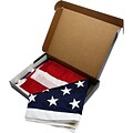
United States
3' x 5'
American
Flag
N/A
Outdoor
3
36
Nylon
1
5
60
N/A
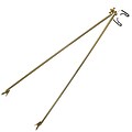
Other
N/A
N/A
Adjustable (357287)
N/A
Flagzone
N/A
N/A
Other
N/A
Flag
N/A
N/A
N/A
N/A
Metal
1
N/A
N/A
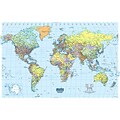
World
World
Not Laminated
Globes
N/A
5 + years
House of Doolittle
N/A
N/A
N/A
N/A
N/A
33
N/A
N/A
N/A
Polyethylene
1
N/A
N/A
Shop Maps & Globes
(113 Products)
Sort by:
Best match
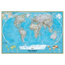
National Geographic World Classic Wall Map, Mural, 110" x 76.5" (NGMRE00622007)
Item #: 901-JV62402
Mural World Map
Size(s): 110" x 76.5"
Material(s): Laminated Paper
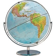
Advantus® 12" Political World Globe, Blue Oceans
Item #: 901-AVT30502
World globe
Each globe has a diameter of 12"
Globe with raised relief and a full swing meridian
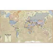
Hemispheres® Boardroom Series World Laminated Wall Map, 38" x 61" (RWPHM03)
Item #: 901-24519762
Modern antique decorative style
Up-to-date cartography and points of interest
Includes countries, capitals, major cities and more


National Geographic Earth's Moon Map, Laminated, 42.5" x 28.5" (NGMRE00620137)
Item #: 901-24611437
National Geographic's "The Earth's Moon" is like having an atlas and almanac in one.
This incredibly informative wall map features detailed depictions of the entire surface of the moon with a selective index showing the named physical features.
Diagrams show the moon's orbital paths, rotation around Earth, librations, how solar and lunar eclipses occur, how the moon affects Earth's tides, and more.


National Geographic World Executive Map, Poster Size and Laminated, 36" x 24" (NGMRE01020376)
Item #: 901-24611378
Expertly researched and designed, National Geographic's World Wall Map is the authoritative map of the world by which other reference maps are measured.
The 36" x 24" poster size supports easy and affordable framing and mounting, and takes less wall space than standard wall maps.
Antique-style "executive" color palette


National Geographic World Satellite Map, Laminated, 43.5" x 30.5" (NGMRE00622011)
Item #: 901-24611314
National Geographic's striking satellite map of The World is a visually stunning image that makes a wonderful addition.
Measures 43.5" x 30.5"
The beauty and complexity of Earth's landscapes, both above and below the oceans, is revealed with the Global Satellite Mosaic.


National Geographic World Classic Map, Laminated, 43.5" x 30.5" (NGMRE00622002)
Item #: 901-24611430
Expertly researched and designed, National Geographic's World Wall Map is the authoritative map of the world by which other reference maps are measured.
Measures 43.5" x 30.5"
Signature Classic style map with bright, easy to read color palette with blue oceans and colorful borders


National Geographic World Physical Map, Enlarged and Laminated, 69.25" x 46.25" (NGMRE00620133)
Item #: 901-24611445
Expertly researched and designed, National Geographic's The Physical World map highlights the Earth's land and undersea forms with exquisite hand-painted relief.
Two corner inset maps show the Earth's crust and world climatic zones.
Enlarged maps provide an immersive experience in any home or office environment. The exceptional cartography is even easier to appreciate at the larger size


National Geographic Space, Stargazer folded Map Pack Bundle, Folded: 4.25" x 9.25" ; Flat: 25.25" x 18.5" (NGMRE01021309B)
Item #: 901-24611454
National Geographic's Stargazer Map and Guides Map Pack Bundle of Space includes maps that get progressively further from Earth on four waterproof tear-resistant maps.
Measures 4.25" x 9.25" folded and 25.25" x 18.5" flat
Each Stargazer Map and Guide shows detailed maps and graphics to help locate features on the moon, planets, and stars.
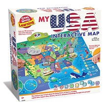
Small World Toys My USA Interactive Map, 30.7" x 24" (SWT9721053)
Item #: 901-24519539
Great learning and educational toy
Interactive talking map
Great way for children to learn the USA map while playing

National Geographic Antarctica Satellite Map, Laminated, 31.25" x 20.25" (NGMRE00620144)
Item #: 901-24611405
National Geographic Antarctica Satellite Wall Map has a striking view of Antarctica's terrain, compiled from 4,500 satellite scans
Additional inset maps show surface elevation, ice sheet thickness, velocity of ice flow, and sea ice movement and windflow.
The map is encapsulated in heavy-duty 1.6 mil laminate which makes the paper much more durable and resistant to the swelling and shrinking caused by changes in humidity.


National Geographic World Executive Map, Enlarged and Laminated, 73" x 48" (NGMRE00622088)
Item #: 901-24611311
Expertly researched and designed, National Geographic's World Wall Map is the authoritative map of the world by which other reference maps are measured.
Measures 73" x 48"
Antique-style "executive" color palette
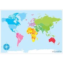
Ashley Productions Smart Poly™ Learning Mats, 12" x 17", Double-Sided, World Basic Map, Pack of 10 (ASH95602)
Item #: 901-24389567
Water Resistant
Colorful designs on both sides
Measures 12" x 17", pack of 10 learning mats


National Geographic Appalachian Trail Map, Laminated, 18" x 48" (NGMRE01020743)
Item #: 901-24611441
Expertly researched and designed, National Geographic's map of the Appalachian Trail is ideal for fans and hikers of this magnificent national scenic trail.
Measures 18" x 48"
It makes a great planning tool or as reference to track progress on the 2,200 mile length.


National Geographic World Classic Map, Poster Size and Laminated, 36" x 24" (NGMRE01020381)
Item #: 901-24611380
Expertly researched and designed, National Geographic's World Wall Map is the authoritative map of the world by which other reference maps are measured.
The 36" x 24" poster size supports easy and affordable framing and mounting, and takes less wall space than standard wall maps.
Signature Classic style map with bright, easy to read color palette with blue oceans and colorful borders
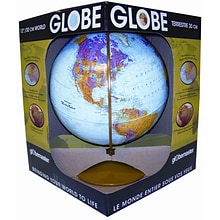
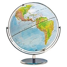
Replogle Globes The Explorer Globe, 12" (REP30519)
Item #: 901-JV23999851
Classroom World Globe
Size(s): 12" diameter
Material(s): Plastic


National Geographic United States for Kids Map, Laminated, 24" x 36" (NGMRE01021159)
Item #: 901-24611434
Expertly researched and designed, National Geographic's The United States for Kids wall map is an enticing and engaging United States map perfect for classroom, home or library.
Measures 24" x 36"
Recommended by geography educators for ages 7–12, this map features an optimized map design for readability and easy, intuitive learning.


National Geographic Appalachian Trail Map, In Gift Box, 18" x 48" (NGMRE01020716X)
Item #: 901-24611439
Expertly researched and designed, National Geographic's map of the Appalachian Trail is ideal for fans and hikers of this magnificent national scenic trail.
Measures 18" x 48"
It makes a great planning tool or as reference to track progress on the 2,200 mile length.


National Geographic The Dynamic Earth, Plate Tectonics Map, Laminated, 36" x 24" (NGMRE01020634)
Item #: 901-24611386
National Geographic Dynamic Earth, Plate Tectonics Wall Map illustrates plate tectonics & features stunning bathymetry & naturally colored relief, as well as volcano and earthquake data through 2011.
Measures 36" x 24"
The Dynamic Earth map illustrates 17 major tectonic plates and highlights diffuse plate boundaries, convergent boundaries, spreading boundaries, fault zones, hot spots, and more.
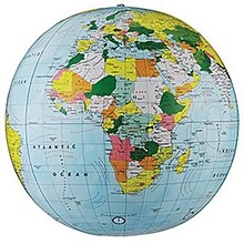
Replogle Globe Political Inflate-A-Globe, Light Blue, 12", 2/Bundle
Item #: 901-883184
Style: Political
Size: 12"(Dia)
Introduce children to geography with this inflatable globe, available in a variety of sizes and styles, each globe is brilliantly colored and extremely durable


Ghent® Maprail Flag Holder, 1", 2 EA/BD
Item #: 901-877757
Add lots of capability to the rail
Grades: All
Age: All
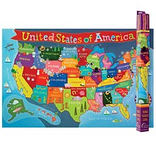
Round World Products United States Map for Kids, 24" x 36" (RWPKM02)
Item #: 901-JV66748
Kids U.S.A Map
Size(s): 24" x 36"
Material(s): Laminated Paper

Teacher Created Resources Map Charts Set 9 Charts, 22" x 17" (TCR9689)
Item #: 901-JV24063211
Map Charts
22" x 17"
5+
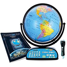
Replogle Globes Intelliglobe II 12" Dia. Deluxe Interactive Globe (RE-39871)
Item #: 901-24451753
Interactive, electronic globe
12 Inch Diameter
Made from 100% Reclaimed Paper Fiber and Plastic, Multicolored

