


We're sorry, this item is no longer available Choose an alternative
Product details
Reviews
Age Range
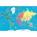
Brand
Continental Coverage
Geographic Region
Height in Inches
Laminated
Map & Globe Type
Material of Item
Pack Qty
Width in Inches
Item no longer available

Item # 901-24439088
N/A
Replogle Globes
N/A
N/A
N/A
N/A
N/A
N/A
N/A
N/A
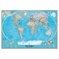
Shop Maps & Globes
(112 Products)
Sort by:
Best match


Item #:901-24611428
$27.99
Per each


Item #:901-24611392
$63.99
Per each


Item #:901-24611382
$37.79
Per each


Item #:901-24611374
$25.99
Per set


Item #:901-24611371
$24.29
Per each


Item #:901-24611431
$32.69
Per each


Item #:901-24611415
$24.29
Per each


Item #:901-24611430
$36.19
Per each


Item #:901-24611443
$30.99
Per set


Item #:901-24611317
$27.99
Per each

Item #:901-JV62863
5
(1)
$129.19
Per each

Item #:901-JV158524
2.4
(5)
$29.39
Per each


Item #:901-24611311
$63.99
Per each


Item #:901-24611366
$24.29
Per each


Item #:901-24611410
$24.29
Per each

Item #:901-24451753
$255.19
Per each

Item #:901-JV158533
4.5
(8)
$50.39
Per each


Item #:901-24611369
$36.79
Per each


Item #:901-24611413
$36.19
Per each


Item #:901-24611454
$36.99
Per set


Item #:901-24611398
$147.19
Per each


