Page 15 of world u s universal maps
(445 items found)
Sort by:
Best match
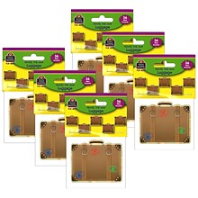
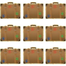
Teacher Created Resources Travel the Map Luggage Mini Accents, 36 Per Pack, 6 Packs (TCR8572-6)
Item #: 901-24498638
Cut-Outs for Classroom Decoration and More
Measures 2-5/8"
Multicolored
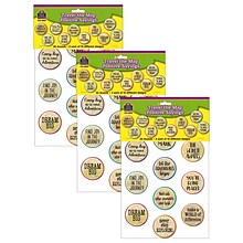
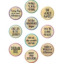
Teacher Created Resources Travel the Map Positive Saying Accents, 30 Per Pack, 3 Packs (TCR8809-3)
Item #: 901-24498852
Cut-Outs for Classroom Decoration and More
Measures approx. 6"
Multicolored

Medical Arts Press® Heavy-Duty Expansion Folders; 14 Point, 50/Box
Item #: 901-52351
Reinforced side edge increases durability.
Longlasting Tyvek® expansion gusset allows folders to expand up to 1-1/2 in.
Embossed score lines on tabs.
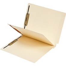
Medical Arts Press® Economy Mylar-Spine Classification Folders; 11- pt, Manila
Item #: 901-50700MAP
Folders have heat-bonded fasteners in positions 1 and 3 and on both sides of the preinstalled divider.
Double-thick full-cut end tabs are embossed with score lines for easy label application.
Front panel of folder is scored for 3/4” expansion to handle heavy volume.

Maped 5" Koopy Spring-Assisted Educational Scissors, Blunt Tip, Black/White Handle, Pack of 20 (MAP137910)
Item #: 901-24526370
These scissors teach kids how to cut safely, with a spring activated handle that automatically spring open for assisted cutting!
5"
Stainless steel blades to withstand even the toughest youngster and will cut all standard classroom materials!

Teacher Created Resources Travel the Map Letters,4", Multicolored, 230/Pack (TCR8575)
Item #: 901-24519736
These letters can be used to create bulletin boards, classroom centers, signs, banners, and other displays
They punch out easily and are coated for durability
Each pack includes 230 pieces


Helix® Vellum Paper Pad, 100% Rag, 11" x 17", White, 50 Sheets (MAP37106)
Item #: 901-24491581
Vellum pad for technical drawing, tracing, blueprints and more
100% Cotton Rag Vellum is more durable than standard pulp paper
16-lb. stock
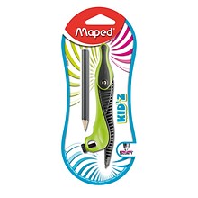
Maped Kid'z Compass with Safety Tip & Pencil, Bundle of 12 (MAP191610)
Item #: 901-23999625
Plastic and comes in assorted colors
Non-slip grip
7.5"L x 3.5"W


Melissa & Doug PAW Patrol Pup Pack Backpack Play Set (33271)
Item #: 901-24623453
Suit up for PAW Patrol missions with the sturdy kid-sized Pup Pack backpack with tools and accessories to save the day
Includes working whistle with clip, adjustable binoculars, 3-in-1 tool with magnifier, red lens, and compass, fold-out mission map and activity guide, write-on badge, pretend pup treats in a pouch
4 double-sided mission cards slide into a PupPad—great story-starters for imaginative missions
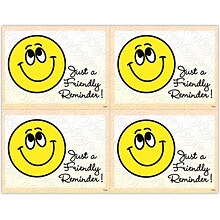
Graphic Image Laser Postcards, Smiley Face, "Just a Friendly Reminder"
Item #: 901-100660
Occasion: Reminder
MAP® Brand Graphic Image Laser Postcards Smiley Face, "Just a Friendly Reminder"come in packs of 100 postacrds for easy mailing. Available in a variety of colors and patterns for use on laser printers. Laser postcards let you personalize each message
for convenience. ...
for convenience. ...

Scenic Deluxe Laser Postcards, Clouds
Item #: 901-47030MAP
Occasion: Recall
MAP® Brand Scenic Deluxe Laser Postcards Cloudscome in packs of 100 postacrds for easy mailing. Available in a variety of colors and patterns for use on laser printers. Laser postcards let you personalize each message for convenience.
Laser postcard sheets give you four full-color designs on every 8-1/2x11" laser postcard sheet
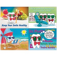
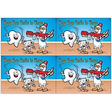
Toothguy® Assorted Laser Postcards, Healthy Smile
Item #: 901-305680
Occasion: Recall
MAP® Brand Toothguy® Assorted Laser Postcards Healthy Smilecome in packs of 100 postacrds for easy mailing. Available in a variety of colors and patterns for use on laser printers. Laser postcards let you personalize each message for convenience.
Laser postcard sheets give you four full-color designs on every 8-1/2x11" laser postcard sheet


TREND The United States Wipe-Off Learning Set (T-19017)
Item #: 901-24600211
United States map dry erase bulletin board set
Larger charts are 10-3/4" x 16-1/8". 74 pieces total.
Multicolored
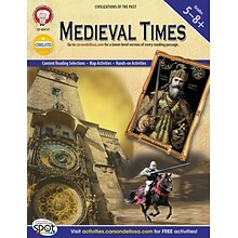
Mark Twain Medieval Times Resource Book
Item #: 901-812331OSA
Grades 5 - 8+
Features hands-on activities, research opportunities, and mapping exercises engage students in learning
Includes a downloadable version of the reading text at a 4-5 grade reading level for struggling readers
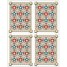
Dental Laser Postcards; American Star Quilt
Item #: 901-30327M
MAP® Brand Graphic Image Laser Postcards Star Quiltcome in packs of 100 postacrds for easy mailing. Available in a variety of colors and patterns for use on laser printers. Laser postcards let you personalize each message for convenience.
Laser postcard sheets give you four full-color designs on every 8-1/2x11" laser postcard sheet
Printed on high-grade coated stock for more vibrant color
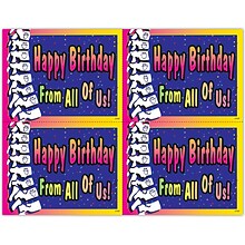
Chiropractic Laser Postcard, Birthday “From All Of Us”
Item #: 901-17737
Occasion: Birthday
MAP® Brand Graphic Image Laser Postcards Birthday "From All Of Us"come in packs of 100 postacrds for easy mailing. Available in a variety of colors and patterns for use on laser printers. Laser postcards let you personalize each message for convenien
ce. ...
ce. ...
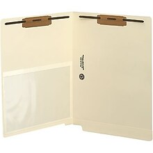
Medical Arts Press® End-Tab Folders with Poly Pockets; 2 Fasteners, 50/Box
Item #: 901-52328
Folder is scored for 3/4 expansion.
Size: 12-1/4W x 9-1/2H overall, 11-3/4W body.
50 per box.
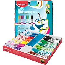
Maped® Marker 'Peps Dry Erase Markers School Pack, Bullet Tip, Assorted Colors, Pack of 168 (MAP741804)
Item #: 901-24519390
Fine Tip Dry Erase Markers great for school, home or office use
Assorted colors
Low-odor ink is super & bright
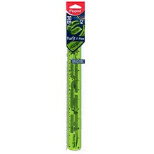
Maped Twist'n Flex Ruler 12" / 30CM, bundle of 20 (MAP279010)
Item #: 901-23999643
Plastic and comes in assorted colors
Inches and Centimeters
12"L x 2"W


Banana Panda What in the World Young Explorers 168-Piece Jumbo Floor Puzzle (BPN33672)
Item #: 901-24630075
Great educational value - perfect for learning about nature, landmarks and discoveries through fun puzzle play
A fun puzzle and world map in one - Kids learn fun facts about the world when putting this jumbo 168-piece floor puzzle together
High-quality sturdy pieces are made from thick cardboard that provide a snug fit when pieced together


Child's Play Books Raccoon Rambles, 4/Set (CPY9781835320792)
Item #: 901-24618990
These books provide a good starting point for illustrating how young children might map their own steps.
Young children can follow raccoon's routes to some of his favorite places.
Set of 4 books: Beach, Home, Park, and City.
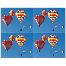
Scenic Laser Postcards, Colorful Air Balloons
Item #: 901-628760
Occasion: Recall
MAP® Brand Scenic Laser Postcards Colorful Air Balloonscome in packs of 100 postacrds for easy mailing. Available in a variety of colors and patterns for use on laser printers. Laser postcards let you personalize each message for convenience.
Laser postcard sheets give you four full-color designs on every 8-1/2x11" laser postcard sheet
Smile Team™ Laser Postcards; Smile in Shape
Item #: 901-36149Q
MAP® Brand Smile Team Laser Postcards Smile in Shapecome in packs of 100 postacrds for easy mailing. Available in a variety of colors and patterns for use on laser printers. Laser postcards let you personalize each message for convenience.
Laser postcard sheets give you four full-color designs on every 8-1/2x11" laser postcard sheet
Printed on high-grade coated stock for more vibrant color

Smile Team™ Laser Postcards, Interactive- Find 10 Differences
Item #: 901-37379
Occasion: Recall
MAP® Brand Smile Team Laser Postcards Interactive- Find 10 Differencescome in packs of 100 postacrds for easy mailing. Available in a variety of colors and patterns for use on laser printers. Laser postcards let you personalize each message for conve
nience. ...
nience. ...


