We're sorry, this item is no longer available Choose an alternative
Product details
Reviews
Brand
Continental Coverage
Depth in Inches
Geographic Region
Height in Inches
Laminated
Length (ft.)
Length in Inches
Map & Globe Type
Pack Qty
Weight (lbs.)
Width in Inches
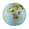
Item no longer available
Item # 901-JV45262
Replogle Globes
World
0.7
World
5.8
Not Laminated
0.48
5.8
Globes
1
0.15
5.7
Shop Maps & Globes
(112 Products)
Sort by:
Best match
Round World Products, World Map for Kids, 24" x 36" (RWPKM01)
Item #: 901-24062999
Kids world map
24" x 36"
Laminated. Assorted colors
Replogle Globes Inflatable Topographical Globe, 12"(Dia), 2 Ea
Item #: 901-932907
Age group and grade: Ages all and grades all
Subject: Social studies
Globe features: Physical map styling, inflatable
Waypoint Geographic 4" Diameter Blue Ocean GyroGlobe, Pack of 2 (RWPWP50200-2)
Item #: 901-24515200
4" Compact mini globe
Features swivel and tilt multi-directional motion allowing the globe to easily rotate in all directions
Distinguished by it's multi-color styling which makes learning about and identifying locations easy!
National Geographic Appalachian Trail Map, In Gift Box, 18" x 48" (NGMRE01020716X)
Item #: 901-24611439
Expertly researched and designed, National Geographic's map of the Appalachian Trail is ideal for fans and hikers of this magnificent national scenic trail.
Measures 18" x 48"
It makes a great planning tool or as reference to track progress on the 2,200 mile length.
National Geographic World and United States Classic, Poster Size, Map Pack Bundle, 36" x 24" (NGMRE01021231B)
Item #: 901-24611427
National Geographic's World and United States maps are the standard by which all other reference maps are measured.
Measures 36" x 24"
The signature Classic style maps use a bright, easy to read color palette featuring blue oceans and stunning shaded relief that has been featured on National Geographic wall maps for over 75 years.
National Geographic Space, Stargazer folded Map Pack Bundle, Folded: 4.25" x 9.25" ; Flat: 25.25" x 18.5" (NGMRE01021309B)
Item #: 901-24611454
National Geographic's Stargazer Map and Guides Map Pack Bundle of Space includes maps that get progressively further from Earth on four waterproof tear-resistant maps.
Measures 4.25" x 9.25" folded and 25.25" x 18.5" flat
Each Stargazer Map and Guide shows detailed maps and graphics to help locate features on the moon, planets, and stars.
National Geographic Antarctica Satellite Map, Laminated, 31.25" x 20.25" (NGMRE00620144)
Item #: 901-24611405
National Geographic Antarctica Satellite Wall Map has a striking view of Antarctica's terrain, compiled from 4,500 satellite scans
Additional inset maps show surface elevation, ice sheet thickness, velocity of ice flow, and sea ice movement and windflow.
The map is encapsulated in heavy-duty 1.6 mil laminate which makes the paper much more durable and resistant to the swelling and shrinking caused by changes in humidity.
Pacon® Corporation® Learning Walls® US Map (PAC78760)
Item #: 901-JV38297
Subject: Social studies
Subject: Science/technology, nonfiction
Dimensions: 48" x 72"
National Geographic United States for Kids Map, Laminated, 24" x 36" (NGMRE01021159)
Item #: 901-24611434
Expertly researched and designed, National Geographic's The United States for Kids wall map is an enticing and engaging United States map perfect for classroom, home or library.
Measures 24" x 36"
Recommended by geography educators for ages 7–12, this map features an optimized map design for readability and easy, intuitive learning.
National Geographic World Decorator Map, Laminated, 46" x 30.5" (NGMRE00622079)
Item #: 901-24611317
Expertly researched and designed, National Geographic's World Wall Map is the authoritative map of the world by which other reference maps are measured.
Measures 46" x 30.5"
Colorful Decorator style map with vibrant color palette that fills each country for easy identification
National Geographic The Dynamic Earth, Plate Tectonics Map, Laminated, 36" x 24" (NGMRE01020634)
Item #: 901-24611386
National Geographic Dynamic Earth, Plate Tectonics Wall Map illustrates plate tectonics & features stunning bathymetry & naturally colored relief, as well as volcano and earthquake data through 2011.
Measures 36" x 24"
The Dynamic Earth map illustrates 17 major tectonic plates and highlights diffuse plate boundaries, convergent boundaries, spreading boundaries, fault zones, hot spots, and more.
National Geographic World Physical Map, Enlarged and Laminated, 69.25" x 46.25" (NGMRE00620133)
Item #: 901-24611445
Expertly researched and designed, National Geographic's The Physical World map highlights the Earth's land and undersea forms with exquisite hand-painted relief.
Two corner inset maps show the Earth's crust and world climatic zones.
Enlarged maps provide an immersive experience in any home or office environment. The exceptional cartography is even easier to appreciate at the larger size
Teacher Created Resources Map Charts Set 9 Charts, 22" x 17" (TCR9689)
Item #: 901-JV24063211
Map Charts
22" x 17"
5+
House of Doolittle Laminated World Map, 50" x 33" (HOD710)
Item #: 901-JV158533
Laminated Classroom World Map
Size: 33"(H) x 50"(W)
Material(s): Recycled Paper/Polyethylene
National Geographic Maps South America Wall Map, 24" x 30"
Item #: 901-JV158528
Subject: Social studies
Subject: Science/technology, nonfiction
Classic map of South America shows political boundaries, place-names, airports, major roads and highways, and other geographic features for the entire continent
Small World Toys My USA Interactive Map, 30.7" x 24" (SWT9721053)
Item #: 901-24519539
Great learning and educational toy
Interactive talking map
Great way for children to learn the USA map while playing
Replogle Globe Political Inflate-A-Globe, Light Blue, 12", 2/Bundle
Item #: 901-883184
Style: Political
Size: 12"(Dia)
Introduce children to geography with this inflatable globe, available in a variety of sizes and styles, each globe is brilliantly colored and extremely durable
National Geographic Pacific Crest Trail Map, In Gift Box, 18" x 48" (NGMRE01020758X)
Item #: 901-24611433
Expertly researched and designed, National Geographic's map of the Pacific Crest Trail is ideal for fans and hikers of this magnificent National Scenic Trail.
Measures 18" x 48"
It makes a great planning tool or as reference to track progress on the 2,600 plus mile length.
National Geographic The Americas Classic Map, Laminated (NGMRE00620152)
Item #: 901-24611431
Expertly researched and designed, National Geographic's The Americas Wall Map is the authoritative map of Europe by which other reference maps are measured.
Measures 23.75" x 36.5"
Signature Classic style map with bright, easy to read color palette with blue oceans and colorful borders
Learning Resources Inflatable Globe, Labeling
Item #: 901-JV35588
Age group and grade: Ages 5 - 8 and grades kindergarten+
Large 27" inflatable globe printed with only the continents and lines of latitude and longitude
Size: 27"(Dia)
National Geographic World and United States Coloring, Map Pack Bundle, 36" x 24" (NGMRE01021221B)
Item #: 901-24611425
National Geographic's cartographers adapted our World and United States for Kids Maps to black and white outline versions that you can color.
Measures 36" x 24"
The World and United States Coloring Maps include country and state flags that can all be colored along with a bonus full color letter size sheets that has all of the flags.
National Geographic Continental Divide Trail Map, Laminated, 18" x 48" (NGMRE01021203)
Item #: 901-24611371
National Geographic Continental Divide Trail Wall Map- National Geographic's map of the Continental Divide Trail is ideal for fans and hikers of this magnificent National Scenic Trail.
Measures 18" x 48"
It makes a great planning tool or as reference to track progress on the 3,100 plus mile length.
National Geographic Destination Mars: 2-Sided Map, Laminated, 31.25" x 20.25" (NGMRE00620141)
Item #: 901-24611411
Destination Mars was created for National Geographic with over 1,000 images taken by the Mars Orbiter Camera, and merged with 330 million elevation points to create the sharpest view yet of Mars.
See Mars as it really looks, from the heights of Olympus Mons, to Hellas Planitia, the lowest point on Mars, where a meteorite punched a hole in the surface 1,300 miles wide and five miles deep.
Measures 31.25" x 20.25"
National Geographic Night Sky, Stargazer folded Map Pack Bundle, Folded: 4.25" x 9.25" ; Flat: 25.25" x 18.5" (NGMRE01021310B)
Item #: 901-24611374
National Geographic's The Night Sky - Stargazer Map Pack the Northern Hemisphere is centered on Polaris, the North Star, the Southern Hemisphere is centered near Crux, the Southern Cross.
Measures 4.25" x 9.25" folded and 25.25" x 18.5" flat
As the Earth moves in its orbit around the Sun the constellations in the sky change. The Night Sky maps include four seasonal charts that are specific for each season.
