Page 4 of Maps & Globes
(113 Products)
Sort by:
Best match


National Geographic Earth's Moon Map, Laminated, 42.5" x 28.5" (NGMRE00620137)
Item #: 901-24611437
National Geographic's "The Earth's Moon" is like having an atlas and almanac in one.
This incredibly informative wall map features detailed depictions of the entire surface of the moon with a selective index showing the named physical features.
Diagrams show the moon's orbital paths, rotation around Earth, librations, how solar and lunar eclipses occur, how the moon affects Earth's tides, and more.
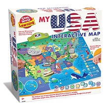
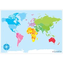
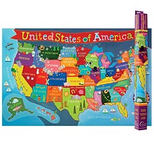
Small World Toys My USA Interactive Map, 30.7" x 24" (SWT9721053)
Item #: 901-24519539
Great learning and educational toy
Interactive talking map
Great way for children to learn the USA map while playing
Hemispheres Blue Ocean Series World & USA Laminated Wall Maps, 2-Pack (RWPHMB02PK)
Item #: 901-JV1112500
Classroom U.S.A & World Map
Size(s): 38" x 51" World, 38" x 48" USA
Material(s): Laminated Paper

National Geographic Australia Classic Map, Laminated, 30.25" x 27" (NGMRE00620146)
Item #: 901-24611407
Expertly researched and designed, National Geographic's Australia Wall Map is the authoritative map of Asia by which other reference maps are measured.
Signature Classic style map with bright, easy to read color palette with blue oceans and colorful borders
Clearly defined international boundaries, cities, islands, airports, and physical features


National Geographic Continental Divide Trail Map, Laminated, 18" x 48" (NGMRE01021203)
Item #: 901-24611371
National Geographic Continental Divide Trail Wall Map- National Geographic's map of the Continental Divide Trail is ideal for fans and hikers of this magnificent National Scenic Trail.
Measures 18" x 48"
It makes a great planning tool or as reference to track progress on the 3,100 plus mile length.


National Geographic United States for Kids Map, Laminated, 24" x 36" (NGMRE01021159)
Item #: 901-24611434
Expertly researched and designed, National Geographic's The United States for Kids wall map is an enticing and engaging United States map perfect for classroom, home or library.
Measures 24" x 36"
Recommended by geography educators for ages 7–12, this map features an optimized map design for readability and easy, intuitive learning.


National Geographic World and United States for Kids, Poster Size, Map Pack Bundle, 36" x 24" (NGMRE01021233B)
Item #: 901-24611447
National Geographic's The World for Kids and United State for Kids wall maps are enticing and engaging world and United States maps perfect for classroom, home or library.
Measures 36" x 24"
Recommended by geography educators for ages 7–12, these maps feature an optimized map design for readability and easy, intuitive learning.
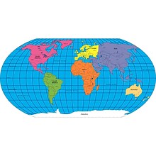
Ashley Productions Smart Poly 12" x 17" World Basic Map Learning Mat, Double-Sided (ASH95002)
Item #: 901-24529536
Heavy duty double-sided surface, no lamination required
Use with dry erase or water based markers and washable crayons
Water Resistant
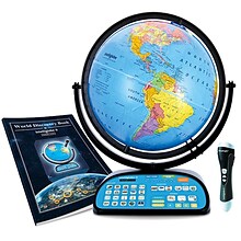
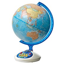
Replogle Globes Intelliglobe II 12" Dia. Deluxe Interactive Globe (RE-39871)
Item #: 901-24451753
Interactive, electronic globe
12 Inch Diameter
Made from 100% Reclaimed Paper Fiber and Plastic, Multicolored
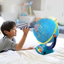
Educational Insights GeoSafari Jr. Talking Globe
Item #: 901-24366639
Travel the globe and discover the fascinating world of geography, animals, and nature
12” Globe featuring dual-swivel action and smart stylus pen with built-in speaker
Over 1,000 facts about animals and nature, countries and cities, continents and oceans
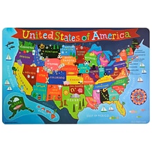
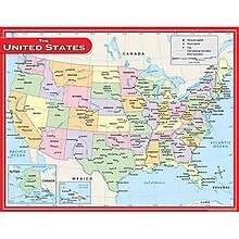
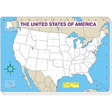
Round World Products United States Map for Kids, 24" x 36" (RWPKM02)
Item #: 901-JV66748
Kids U.S.A Map
Size(s): 24" x 36"
Material(s): Laminated Paper


National Geographic The World for Kids Map, Laminated, 36" x 24" (NGMRE01020772)
Item #: 901-24611323
Expertly researched and designed, National Geographic's The World for Kids wall map is an enticing and engaging world map perfect for classroom, home or library.
Measures 36" x 24"
Recommended by geography educators for ages 7–12, this map features an optimized map design for readability and easy, intuitive learning.


National Geographic United States Classic Map, Poster Size and Laminated, 36" x 24" (NGMRE01020385)
Item #: 901-24611423
National Geographic United States Wall Map is expertly researched and designed, National Geographic's United States wall map is the standard by which other reference maps of the U.S. are measured.
The 36" x 24" poster size supports easy and affordable framing and mounting, and takes less wall space than standard wall maps.
Antique-style "executive" color palette
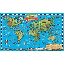
Popar 32" x 54" Kid's World Map Interactive Wall Chart with Free App (RWPWC04)
Item #: 901-24526317
Read-alongs and videos about the ancient world, modern world, and natural wonders
Measures 32" x 54"
Interactive with free app
Round World Junior Kid's USA PlaceMap (RWPKPM02)
Item #: 901-24529215
Printed on tested safe sturdy material
Easy to wipe and clean with a damp cloth
Make meal time, fun time!
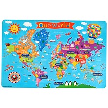
Round World Junior Kid's World PlaceMap (RWPKPM01)
Item #: 901-24529200
Printed on tested safe sturdy material
Easy to wipe and clean with a damp cloth
Make meal time, fun time!
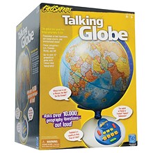
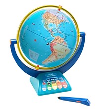
Educational Insights GeoSafari® Talking Globe® (EI-8895)
Item #: 901-24514965
GeoSafari Talking Globe includes more than 1, geography questions for grades 3 and up!
Choose from U.S.A./Canada, World, or ALL quiz categories, listen to the question, then use the keypad to enter your answer!
Improve your geography knowledge on your own or play with a friend—Talking Globe is perfect for up to 4 players.
Ashley Productions Smart Poly 12" x 17" Canada Basic Map Learning Mat, Double-Sided (ASH95004)
Item #: 901-24529001
Heavy duty double-sided surface, no lamination required
Use with dry erase or water based markers and washable crayons
Water Resistant
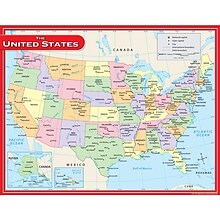
Teacher Created Resources US Map Chart, 17"W x 22"H, 10/Bundle (TCR7657)
Item #: 901-879555
Theme/design: Social studies
Color: Assorted
Size: 17"(H) x 22"(W)
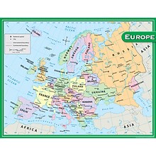
Teacher Created Resources Europe Map Chart, 17"W x 22"H (TCR7654)
Item #: 901-JV47411
Theme/design: Social studies
Color: Assorted
Age group and grade: Ages 5 - 11 and grades 1st - 5th
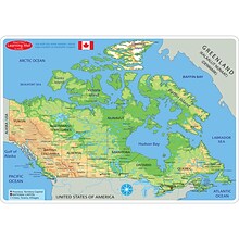
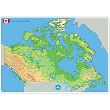
Ashley Productions Smart Poly 12" x 17" Physical Canada Map Learning Mat, Double-Sided (ASH95024)
Item #: 901-24529474
Heavy duty double-sided surface, no lamination required
Use with dry erase or water based markers and washable crayons
Water Resistant
Shapes Etc Practice Map, Labeled, 8x16", World
Item #: 901-JV52635
Age group and grade: Ages all and grades all
Subject: Map skills
Multi use notepad is an excellent learning tool


National Geographic World Satellite Map, Laminated, 43.5" x 30.5" (NGMRE00622011)
Item #: 901-24611314
National Geographic's striking satellite map of The World is a visually stunning image that makes a wonderful addition.
Measures 43.5" x 30.5"
The beauty and complexity of Earth's landscapes, both above and below the oceans, is revealed with the Global Satellite Mosaic.
Jumbo Map Pads, U.S. Map, Blank
Item #: 901-JV40309
Subject: Social studies
Subject: Science/technology, nonfiction
Perfect for testing geography knowledge! 30 sheets per pad(15 7/8" x 10 3/4" each) with all the states left blank for testing


