Page 4 of Maps & Globes
(113 Products)
Sort by:
Best match
Advantus® 12" Political World Globe, Blue Oceans
Item #: 901-AVT30502
World globe
Each globe has a diameter of 12"
Globe with raised relief and a full swing meridian
Pacon® Corporation® Learning Walls® World Map (PAC78770)
Item #: 901-JV38298
Subject: Science/technology, nonfiction
Dimensions: 48" x 72"
A place for students and teachers to interact creatively
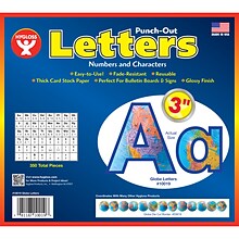
Hygloss Products 3" Punch-Out Letters, Globes (HYG10019)
Item #: 901-JV2127315
Letters/Decoration
Assorted Colors
10.5" x 9" x .5"


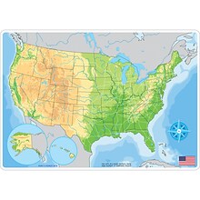
National Geographic National Parks of the United States Map, Laminated, 42" x 30" (NGMRE01020602)
Item #: 901-24611394
Expertly researched and designed, National Geographic's wall map of National Parks of the United States highlights the nearly 400 magnificent parks across America.
Measures 42" x 30"
The country is represented in subtle earth-tones with shaded mountain relief and intricately drawn river systems.
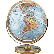
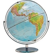
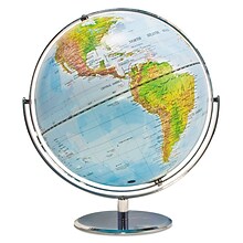
Pioneer Globe
Item #: 901-JV38114
Bright gold finish on numbered full meridian
Map color: Blue
Base material: Plastic
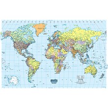
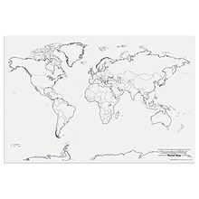
House of Doolittle Laminated World Map, 38" x 25" (HOD711)
Item #: 901-JV158531
Classroom World and U.S.A Map
Size: 25"(H) x 38"(W)
Material(s): Recycled Paper/Polyethylene


National Geographic World Classic Map, Enlarged and Laminated, 69.25" x 48" (NGMRE00622003)
Item #: 901-24611409
Expertly researched and designed, National Geographic's World Wall Map is the authoritative map of the world by which other reference maps are measured.
Measures 69.25" x 48"
Signature Classic style map with bright, easy to read color palette with blue oceans and colorful borders
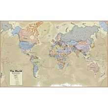
Hemispheres® Boardroom Series World Laminated Wall Map, 38" x 61" (RWPHM03)
Item #: 901-24519762
Modern antique decorative style
Up-to-date cartography and points of interest
Includes countries, capitals, major cities and more


National Geographic World Classic Map, Laminated, 43.5" x 30.5" (NGMRE00622002)
Item #: 901-24611430
Expertly researched and designed, National Geographic's World Wall Map is the authoritative map of the world by which other reference maps are measured.
Measures 43.5" x 30.5"
Signature Classic style map with bright, easy to read color palette with blue oceans and colorful borders


National Geographic World Decorator Map, Laminated, 46" x 30.5" (NGMRE00622079)
Item #: 901-24611317
Expertly researched and designed, National Geographic's World Wall Map is the authoritative map of the world by which other reference maps are measured.
Measures 46" x 30.5"
Colorful Decorator style map with vibrant color palette that fills each country for easy identification
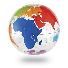

Learning Resources Inflatable Globe, Labeling
Item #: 901-JV35588
Age group and grade: Ages 5 - 8 and grades kindergarten+
Large 27" inflatable globe printed with only the continents and lines of latitude and longitude
Size: 27"(Dia)


National Geographic Pacific Crest Trail Map, In Gift Box, 18" x 48" (NGMRE01020758X)
Item #: 901-24611433
Expertly researched and designed, National Geographic's map of the Pacific Crest Trail is ideal for fans and hikers of this magnificent National Scenic Trail.
Measures 18" x 48"
It makes a great planning tool or as reference to track progress on the 2,600 plus mile length.


National Geographic World and United States for Kids, Poster Size, Map Pack Bundle, 36" x 24" (NGMRE01021233B)
Item #: 901-24611447
National Geographic's The World for Kids and United State for Kids wall maps are enticing and engaging world and United States maps perfect for classroom, home or library.
Measures 36" x 24"
Recommended by geography educators for ages 7–12, these maps feature an optimized map design for readability and easy, intuitive learning.
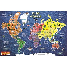
Round World Products, World Map for Kids, 24" x 36" (RWPKM01)
Item #: 901-24062999
Kids world map
24" x 36"
Laminated. Assorted colors


National Geographic The World for Kids Map, Laminated, 36" x 24" (NGMRE01020772)
Item #: 901-24611323
Expertly researched and designed, National Geographic's The World for Kids wall map is an enticing and engaging world map perfect for classroom, home or library.
Measures 36" x 24"
Recommended by geography educators for ages 7–12, this map features an optimized map design for readability and easy, intuitive learning.
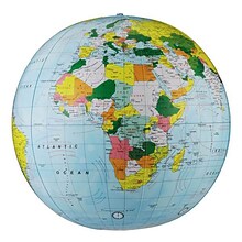
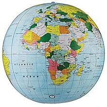
Replogle Globe Political Inflate-A-Globe, Light Blue, 16", 2/Bundle
Item #: 901-880408
Style: Political
Size: 16"(Dia)
Introduce children to geography with this inflatable globe, available in a variety of sizes and styles, each globe is brilliantly colored and extremely durable
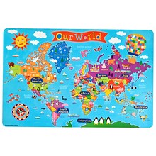
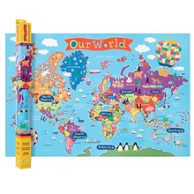
Round World Junior Kid's World PlaceMap (RWPKPM01)
Item #: 901-24529200
Printed on tested safe sturdy material
Easy to wipe and clean with a damp cloth
Make meal time, fun time!
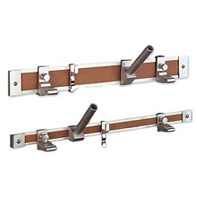
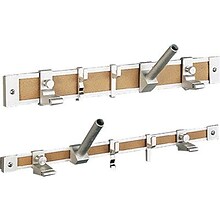
Ghent® Maprail Flag Holder, 1", 2 EA/BD
Item #: 901-877757
Add lots of capability to the rail
Grades: All
Age: All
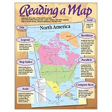
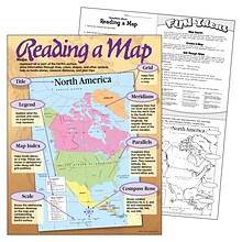
Reading a Map Learning Chart
Item #: 901-JV46162
Theme/design: Classroom
Color: Assorted
Size: 17"(H) x 22"(W)
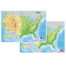
Ashley Productions Smart Poly 12" x 17" U.S. Physical Map Learning Mat, Double-Sided (ASH95001)
Item #: 901-24529533
Heavy duty double-sided surface, no lamination required
Use with dry erase or water based markers and washable crayons
Water Resistant


National Geographic Bird Migration, Western Hemisphere Map, Laminated, 20.25" x 31.25" (NGMRE01020306)
Item #: 901-24611385
National Geographic Bird Migration, Western Hemisphere Wall Map shows the mystery of bird migration and the incredible journeys that birds undertake in the Americas each year.
Measures 20.25" x 31.25"
67 types of birds that migrate are shown on a map of the Americas that is overlaid with pathways that show migration routes from nesting grounds to wintering areas.
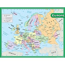
Teacher Created Resources Europe Map Chart, 17"W x 22"H (TCR7654)
Item #: 901-JV47411
Theme/design: Social studies
Color: Assorted
Age group and grade: Ages 5 - 11 and grades 1st - 5th
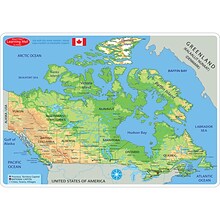
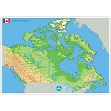
Ashley Productions Smart Poly 12" x 17" Physical Canada Map Learning Mat, Double-Sided (ASH95024)
Item #: 901-24529474
Heavy duty double-sided surface, no lamination required
Use with dry erase or water based markers and washable crayons
Water Resistant
Replogle Kids World Peel & Stick Wall Map, 42" x 30" (RE-72161)
Item #: 901-24439043
Kids World Peel & Stick Wall Map
Map Size: 42" x 30"
Printed on Peel and Stick Repositionable Media

