Page 4 of maps globes social studies
(136 items found)
Sort by:
Best match


National Geographic The Americas Classic Map, Laminated (NGMRE00620152)
Item #: 901-24611431
Expertly researched and designed, National Geographic's The Americas Wall Map is the authoritative map of Europe by which other reference maps are measured.
Measures 23.75" x 36.5"
Signature Classic style map with bright, easy to read color palette with blue oceans and colorful borders


National Geographic World Classic Map, Enlarged and Laminated, 69.25" x 48" (NGMRE00622003)
Item #: 901-24611409
Expertly researched and designed, National Geographic's World Wall Map is the authoritative map of the world by which other reference maps are measured.
Measures 69.25" x 48"
Signature Classic style map with bright, easy to read color palette with blue oceans and colorful borders
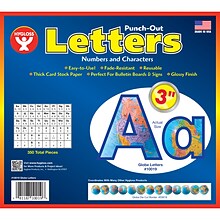
Hygloss Products 3" Punch-Out Letters, Globes (HYG10019)
Item #: 901-JV2127315
Letters/Decoration
Assorted Colors
10.5" x 9" x .5"


National Geographic Night Sky, Stargazer folded Map Pack Bundle, Folded: 4.25" x 9.25" ; Flat: 25.25" x 18.5" (NGMRE01021310B)
Item #: 901-24611374
National Geographic's The Night Sky - Stargazer Map Pack the Northern Hemisphere is centered on Polaris, the North Star, the Southern Hemisphere is centered near Crux, the Southern Cross.
Measures 4.25" x 9.25" folded and 25.25" x 18.5" flat
As the Earth moves in its orbit around the Sun the constellations in the sky change. The Night Sky maps include four seasonal charts that are specific for each season.


National Geographic World Decorator Map, Enlarged and Laminated, 73" x 48" (NGMRE00622080)
Item #: 901-24611320
Expertly researched and designed, National Geographic's World Wall Map is the authoritative map of the world by which other reference maps are measured.
Measures 73" x 48"
Colorful Decorator style map with vibrant color palette that fills each country for easy identification
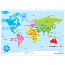

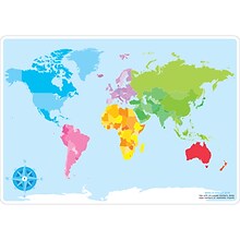
Ashley Productions Smart Poly™ Learning Mats, 12" x 17", Double-Sided, World Basic Map, Pack of 10 (ASH95602)
Item #: 901-24389567
Water Resistant
Colorful designs on both sides
Measures 12" x 17", pack of 10 learning mats


National Geographic The Heavens Map, Laminated, 30.5" x 22.75" (NGMRE00620136)
Item #: 901-24611415
National Geographic's The Heavens shows star charts and constellations for both the Northern and Southern Hemispheres.
All 2,844 of the stars on the chart, plus nebulae and star clusters, can be seen with the unaided eye, making this chart a perfect companion for viewing the night sky.
They inspire great works of art, and tempt our imaginations into creating stories and myths from the shapes we see.


Carson Dellosa Education Scalloped Border, 3"x 3', Let's Explore World Map, 6/Bundle (CD-108481-6)
Item #: 901-24642930
Add excitement to your learning environment with this reusable border
Product Dimension: 3" x 36" strips
The stunning bulletin border features all of the continents of the world in nostalgic colors to add a touch of adventure to your learning displays, wall decor, classroom borders, and more.


National Geographic World Executive Map, Mural, 110" x 76.5" (NGMRE00620092)
Item #: 901-24611398
National Geographic World Wall Map Executive is expertly researched and designed, National Geographic's World Wall Map is the authoritative map of the world by which other reference maps are measured.
Antique-style "executive" color palette
Thousands of place names carefully and artfully placed to maintain legibility in heavily populated areas


Carson-Dellosa Discovery Library Jr Citizens of the World, Hardcover (CD-9781731656322)
Item #: 901-24643094
Fact- and photo-filled text for young readers supports social studies curriculum
For ages 5-8.
Page Count: 24 pages
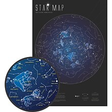
Maps International 33" x 23" Glow in the Dark Star Map (RWPMI03)
Item #: 901-24526461
Map glows in the dark
Measures 33" x 23"
Great way for students to learn the stars and constellation patterns


National Geographic World Executive Map, Enlarged and Laminated, 73" x 48" (NGMRE00622088)
Item #: 901-24611311
Expertly researched and designed, National Geographic's World Wall Map is the authoritative map of the world by which other reference maps are measured.
Measures 73" x 48"
Antique-style "executive" color palette


National Geographic World Classic Map, Poster Size and Laminated, 36" x 24" (NGMRE01020381)
Item #: 901-24611380
Expertly researched and designed, National Geographic's World Wall Map is the authoritative map of the world by which other reference maps are measured.
The 36" x 24" poster size supports easy and affordable framing and mounting, and takes less wall space than standard wall maps.
Signature Classic style map with bright, easy to read color palette with blue oceans and colorful borders
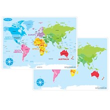
Ashley Productions Smart Poly 12" x 17" World Basic Map Learning Mat, Double-Sided (ASH95002)
Item #: 901-24529536
Heavy duty double-sided surface, no lamination required
Use with dry erase or water based markers and washable crayons
Water Resistant


National Geographic United States Decorator Map, Laminated, 43.5" x 30.5" (NGMRE00622083)
Item #: 901-24611382
National Geographic's Decorator style map of the United States features rich, attractive color fills that bring any room or classroom to life.
Measures 43.5" x 30.5"
Colorful Decorator style map with vibrant color palette that fills each country for easy identification
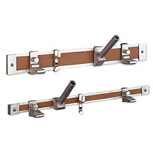
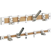
Ghent® Maprail Flag Holder, 1", 2 EA/BD
Item #: 901-877757
Add lots of capability to the rail
Grades: All
Age: All


National Geographic Earth's Moon Map, Laminated, 42.5" x 28.5" (NGMRE00620137)
Item #: 901-24611437
National Geographic's "The Earth's Moon" is like having an atlas and almanac in one.
This incredibly informative wall map features detailed depictions of the entire surface of the moon with a selective index showing the named physical features.
Diagrams show the moon's orbital paths, rotation around Earth, librations, how solar and lunar eclipses occur, how the moon affects Earth's tides, and more.


National Geographic World Executive Map, Poster Size and Laminated, 36" x 24" (NGMRE01020376)
Item #: 901-24611378
Expertly researched and designed, National Geographic's World Wall Map is the authoritative map of the world by which other reference maps are measured.
The 36" x 24" poster size supports easy and affordable framing and mounting, and takes less wall space than standard wall maps.
Antique-style "executive" color palette
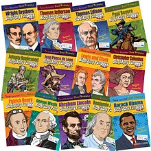
Biography FunBooks, Presidents, Inventors & Explorers
Item #: 901-JV58909
Age group and grade: Ages 6 - 11 and grades 1st - 5th
Subject: Social studies
Provide an overview of each person's life and touch on their childhood education, family, personal obstacles and key accomplishments
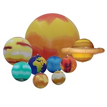
Replogle Inflatable Solar System Set for Students, 9 Planets (RE-17801)
Item #: 901-24439029
Inflatable Solar System Set
Earth Science for ages 5+ years
Set Includes: Sun, Mercury, Venus, Earth, Jupiter, Saturn, Uranus, Neptune, and Pluto
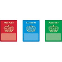
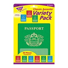
Passports Classic Accents® Variety Pack
Item #: 901-JV59873
Age group and grade: Ages 3 - 15 and grades pre - kindergarten - 9th
Theme: Passports
Add a sense of fun and wonder to every lesson
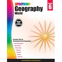
Spectrum Spectrum Geography Grade 6 Workbook (704661)
Item #: 901-1419676OSA
Focuses on population distribution, canals and tributaries, historical events, ecology, map skills, and more
Grade 6
Includes one 128-page book
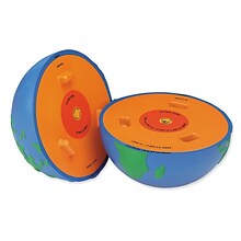
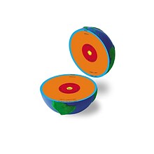
Learning Resources 5" Cross-Section Earth Model (LER2437)
Item #: 901-JV44237
Age group and grade: Ages 3 - 8 and grades pre school - 2nd
Type: Earth science
Each brightly colored hemisphere shows its layers, temperatures and depths

National Geographic Antarctica Satellite Map, Laminated, 31.25" x 20.25" (NGMRE00620144)
Item #: 901-24611405
National Geographic Antarctica Satellite Wall Map has a striking view of Antarctica's terrain, compiled from 4,500 satellite scans
Additional inset maps show surface elevation, ice sheet thickness, velocity of ice flow, and sea ice movement and windflow.
The map is encapsulated in heavy-duty 1.6 mil laminate which makes the paper much more durable and resistant to the swelling and shrinking caused by changes in humidity.


