Page 7 of rand mcnally deluxe maps
(444 items found)
Sort by:
Best match


National Geographic The Americas Classic Map, Laminated (NGMRE00620152)
Item #: 901-24611431
Expertly researched and designed, National Geographic's The Americas Wall Map is the authoritative map of Europe by which other reference maps are measured.
Measures 23.75" x 36.5"
Signature Classic style map with bright, easy to read color palette with blue oceans and colorful borders


National Geographic World Decorator Map, Laminated, 46" x 30.5" (NGMRE00622079)
Item #: 901-24611317
Expertly researched and designed, National Geographic's World Wall Map is the authoritative map of the world by which other reference maps are measured.
Measures 46" x 30.5"
Colorful Decorator style map with vibrant color palette that fills each country for easy identification


National Geographic World Executive Map, Enlarged and Laminated, 73" x 48" (NGMRE00622088)
Item #: 901-24611311
Expertly researched and designed, National Geographic's World Wall Map is the authoritative map of the world by which other reference maps are measured.
Measures 73" x 48"
Antique-style "executive" color palette

National Geographic Antarctica Satellite Map, Laminated, 31.25" x 20.25" (NGMRE00620144)
Item #: 901-24611405
National Geographic Antarctica Satellite Wall Map has a striking view of Antarctica's terrain, compiled from 4,500 satellite scans
Additional inset maps show surface elevation, ice sheet thickness, velocity of ice flow, and sea ice movement and windflow.
The map is encapsulated in heavy-duty 1.6 mil laminate which makes the paper much more durable and resistant to the swelling and shrinking caused by changes in humidity.


National Geographic National Parks & National Forest of the US, Map Pack Bundle (NGMDM01021301B)
Item #: 901-24611388
National Geographic's Destination Maps of National Forests and Grasslands of the United States highlights the 154 national forests and 20 national grasslands across America.
A list of all forest service and grasslands units, sorted by region, is also included to help you find the closest recreational opportunity.
The National Park and National Forest Map Pack Includes: National Parks of the United States & National Forests and Grasslands of the United States


National Geographic Night Sky, Stargazer folded Map Pack Bundle, Folded: 4.25" x 9.25" ; Flat: 25.25" x 18.5" (NGMRE01021310B)
Item #: 901-24611374
National Geographic's The Night Sky - Stargazer Map Pack the Northern Hemisphere is centered on Polaris, the North Star, the Southern Hemisphere is centered near Crux, the Southern Cross.
Measures 4.25" x 9.25" folded and 25.25" x 18.5" flat
As the Earth moves in its orbit around the Sun the constellations in the sky change. The Night Sky maps include four seasonal charts that are specific for each season.


National Geographic The Universe Map, Laminated, 31.25" x 20.25" (NGMRE00620139)
Item #: 901-24611384
National Geographic's Universe Wall Map, shows as far as we can see with our ever-improving telescope, at least a hundred billion galaxies arrayed throughout the universe.
This map uses graphic leaps of scales to show how our solar system fits within the vastness of the universe.
The map also includes a universe timeline and a description of its evolution.


National Geographic Continental Divide Trail Map, In Gift Box, 18" x 48" (NGMRE01021204X)
Item #: 901-24611457
National Geographic Continental Divide Trail Wall Map- National Geographic's map of the Continental Divide Trail is ideal for fans and hikers of this magnificent National Scenic Trail.
Measures 18" x 48"
It makes a great planning tool or as reference to track progress on the 3,100 plus mile length.
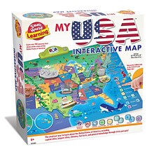
Small World Toys My USA Interactive Map, 30.7" x 24" (SWT9721053)
Item #: 901-24519539
Great learning and educational toy
Interactive talking map
Great way for children to learn the USA map while playing


National Geographic Earth's Moon Map, Laminated, 42.5" x 28.5" (NGMRE00620137)
Item #: 901-24611437
National Geographic's "The Earth's Moon" is like having an atlas and almanac in one.
This incredibly informative wall map features detailed depictions of the entire surface of the moon with a selective index showing the named physical features.
Diagrams show the moon's orbital paths, rotation around Earth, librations, how solar and lunar eclipses occur, how the moon affects Earth's tides, and more.


National Geographic National Parks of the United States Map, Laminated, 42" x 30" (NGMRE01020602)
Item #: 901-24611394
Expertly researched and designed, National Geographic's wall map of National Parks of the United States highlights the nearly 400 magnificent parks across America.
Measures 42" x 30"
The country is represented in subtle earth-tones with shaded mountain relief and intricately drawn river systems.


National Geographic Appalachian Trail Map, In Gift Box, 18" x 48" (NGMRE01020716X)
Item #: 901-24611439
Expertly researched and designed, National Geographic's map of the Appalachian Trail is ideal for fans and hikers of this magnificent national scenic trail.
Measures 18" x 48"
It makes a great planning tool or as reference to track progress on the 2,200 mile length.
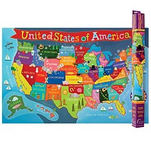
Round World Products United States Map for Kids, 24" x 36" (RWPKM02)
Item #: 901-JV66748
Kids U.S.A Map
Size(s): 24" x 36"
Material(s): Laminated Paper

Teacher Created Resources Map Charts Set 9 Charts, 22" x 17" (TCR9689)
Item #: 901-JV24063211
Map Charts
22" x 17"
5+


National Geographic World Classic Map, Poster Size and Laminated, 36" x 24" (NGMRE01020381)
Item #: 901-24611380
Expertly researched and designed, National Geographic's World Wall Map is the authoritative map of the world by which other reference maps are measured.
The 36" x 24" poster size supports easy and affordable framing and mounting, and takes less wall space than standard wall maps.
Signature Classic style map with bright, easy to read color palette with blue oceans and colorful borders


National Geographic Destination Mars: 2-Sided Map, Laminated, 31.25" x 20.25" (NGMRE00620141)
Item #: 901-24611411
Destination Mars was created for National Geographic with over 1,000 images taken by the Mars Orbiter Camera, and merged with 330 million elevation points to create the sharpest view yet of Mars.
See Mars as it really looks, from the heights of Olympus Mons, to Hellas Planitia, the lowest point on Mars, where a meteorite punched a hole in the surface 1,300 miles wide and five miles deep.
Measures 31.25" x 20.25"

Medical Arts Press® Washington Tamper Resistant Prescription Pads; Standard 2-Part
Item #: 901-26532
Washington mandates that prescriptions are written on forms that meet tamper-resistant requirements and include the seal of approval
State map is heat sensitive to friction or heat, turning from green to yellow
"Dispense as written" and "Substitution permitted" signature lines
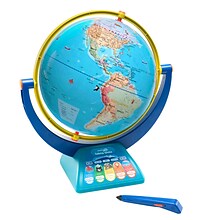
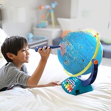
Educational Insights GeoSafari Jr. Talking Globe
Item #: 901-24366639
Travel the globe and discover the fascinating world of geography, animals, and nature
12” Globe featuring dual-swivel action and smart stylus pen with built-in speaker
Over 1,000 facts about animals and nature, countries and cities, continents and oceans
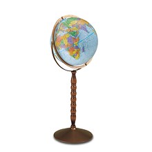
Replogle Globes Treasury Floor Model Globe, 12" (RE-30803)
Item #: 901-JV62863
Classroom World Globe
Size(s): 12" diameter
Material(s): Plastic, Wood, Metal
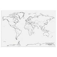
Pacon® Corporation® Learning Walls® World Map (PAC78770)
Item #: 901-JV38298
Subject: Science/technology, nonfiction
Dimensions: 48" x 72"
A place for students and teachers to interact creatively
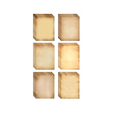
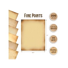
Better Office Paper, Assorted Parchment Designs, 100/Pack (64502)
Item #: 901-24514285
Set of unique antique-looking paper great for invitations, vintage-looking certificates and documents, scavenger hunt maps, antique scrolls for plays and theater, and more
Weathered-look stationery printed in six light- to medium-colored faux parchment designs that allow your handwritten notes or printed text to stand out
Paper size: 8.5" x 11"

Peel & Stick Add-On Filing Pockets, 8-3/4 x 5-1/8, 10/Pack
Item #: 901-70185
Peel & Stick Add-On Filing Pockets
Polypropylene pockets easily adhere to binders and folders for convenient storage
Simply peel away liner and stick—no need for staples or paper clips Provides convenient storage for charts, maps, lists and other full-size documents
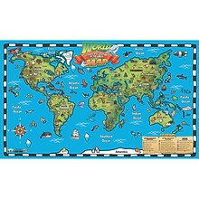
Popar 32" x 54" Kid's World Map Interactive Wall Chart with Free App (RWPWC04)
Item #: 901-24526317
Read-alongs and videos about the ancient world, modern world, and natural wonders
Measures 32" x 54"
Interactive with free app

National Geographic Australia Classic Map, Laminated, 30.25" x 27" (NGMRE00620146)
Item #: 901-24611407
Expertly researched and designed, National Geographic's Australia Wall Map is the authoritative map of Asia by which other reference maps are measured.
Signature Classic style map with bright, easy to read color palette with blue oceans and colorful borders
Clearly defined international boundaries, cities, islands, airports, and physical features


