Page 3 of steck vaughn map skills
(444 items found)
Sort by:
Best match
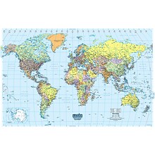
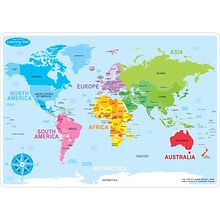
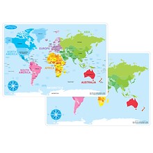
Round World Products, World Map for Kids, 24" x 36" (RWPKM01)
Item #: 901-24062999
Kids world map
24" x 36"
Laminated. Assorted colors

Teacher Created Resources Map Charts Set 9 Charts, 22" x 17" (TCR9689)
Item #: 901-JV24063211
Map Charts
22" x 17"
5+
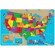
Educational Insights Foam Map Puzzles, USA
Item #: 901-JV37188
Age group and grade: Ages 5 - 7 and grades kindergarten+
Theme/design: Map
Material: Beech wood


National Geographic Triple Crown of Hiking Map, In Gift Box, 18 x 48" (NGMRE01021207X)
Item #: 901-24611421
National Geographic Triple Crown of Hiking Wall Map shows the Appalachian Trail at 2,200 miles, the Pacific Crest Trail at 2,700 miles and the Continental Divide Trail at 3,100 miles.
Measures 18 x 48"
The Triple Crown of Hiking includes these three iconic trails in a decorative gift box that is perfect for the hiker in your life.
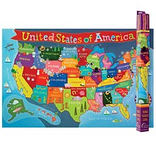
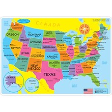
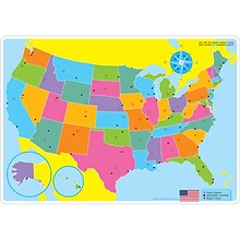
Round World Products United States Map for Kids, 24" x 36" (RWPKM02)
Item #: 901-JV66748
Kids U.S.A Map
Size(s): 24" x 36"
Material(s): Laminated Paper


National Geographic National Parks of the United States Map, Laminated, 42" x 30" (NGMRE01020602)
Item #: 901-24611394
Expertly researched and designed, National Geographic's wall map of National Parks of the United States highlights the nearly 400 magnificent parks across America.
Measures 42" x 30"
The country is represented in subtle earth-tones with shaded mountain relief and intricately drawn river systems.


National Geographic Appalachian Trail Map, Laminated, 18" x 48" (NGMRE01020743)
Item #: 901-24611441
Expertly researched and designed, National Geographic's map of the Appalachian Trail is ideal for fans and hikers of this magnificent national scenic trail.
Measures 18" x 48"
It makes a great planning tool or as reference to track progress on the 2,200 mile length.


National Geographic Appalachian Trail Map, In Gift Box, 18" x 48" (NGMRE01020716X)
Item #: 901-24611439
Expertly researched and designed, National Geographic's map of the Appalachian Trail is ideal for fans and hikers of this magnificent national scenic trail.
Measures 18" x 48"
It makes a great planning tool or as reference to track progress on the 2,200 mile length.
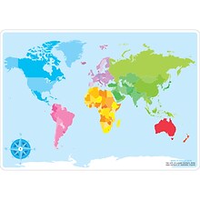
House of Doolittle Laminated World Map, 38" x 25" (HOD711)
Item #: 901-JV158531
Classroom World and U.S.A Map
Size: 25"(H) x 38"(W)
Material(s): Recycled Paper/Polyethylene

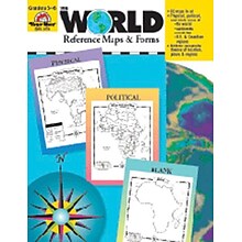
Evan-Moor® The World - Reference Maps & Forms
Item #: 901-JV37097
Age group and grade: Ages 3 - 18 and grades 3rd - 6th
Also includes evaluation forms, crossword puzzle, word search and answer key
Author: Jo Ellen Moore
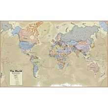
Hemispheres® Boardroom Series World Laminated Wall Map, 38" x 61" (RWPHM03)
Item #: 901-24519762
Modern antique decorative style
Up-to-date cartography and points of interest
Includes countries, capitals, major cities and more
Ashley Productions Smart Poly™ Learning Mats, 12" x 17", Double-Sided, U.S. Basic Map, Pack of 10 (ASH95600)
Item #: 901-24389608
Water Resistant
Colorful designs on both sides
Measures 12" x 17", pack of 10 learning mats


National Geographic The Heavens Map, Laminated, 30.5" x 22.75" (NGMRE00620136)
Item #: 901-24611415
National Geographic's The Heavens shows star charts and constellations for both the Northern and Southern Hemispheres.
All 2,844 of the stars on the chart, plus nebulae and star clusters, can be seen with the unaided eye, making this chart a perfect companion for viewing the night sky.
They inspire great works of art, and tempt our imaginations into creating stories and myths from the shapes we see.
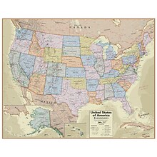
Hemispheres® Boardroom Series United States Laminated Wall Map, 38" x 48" (RWPHM04)
Item #: 901-24519761
Modern antique decorative style
Up-to-date cartography and points of interest
Includes states, capitals and more


National Geographic Destination Mars: 2-Sided Map, Laminated, 31.25" x 20.25" (NGMRE00620141)
Item #: 901-24611411
Destination Mars was created for National Geographic with over 1,000 images taken by the Mars Orbiter Camera, and merged with 330 million elevation points to create the sharpest view yet of Mars.
See Mars as it really looks, from the heights of Olympus Mons, to Hellas Planitia, the lowest point on Mars, where a meteorite punched a hole in the surface 1,300 miles wide and five miles deep.
Measures 31.25" x 20.25"


National Geographic The Milky Way Map, Laminated, 31.25" x 20.25" (NGMRE00620140)
Item #: 901-24611410
This computer-generated image of the Milky Way shows the entire galaxy in one perspective of a 3-D model compiled specially for National Geographic.
The model incorporates the positions of hundreds of thousands of stars and nebulae within the galaxy, shows Earth's location.
Includes additional photographs, descriptions and locations of fascinating phenomena throughout the Milky Way.
Pacon® Corporation® Learning Walls® World Map (PAC78770)
Item #: 901-JV38298
Subject: Science/technology, nonfiction
Dimensions: 48" x 72"
A place for students and teachers to interact creatively

Ashley Productions Smart Poly™ Learning Mats, 12" x 17", Double-Sided, World Basic Map, Pack of 10 (ASH95602)
Item #: 901-24389567
Water Resistant
Colorful designs on both sides
Measures 12" x 17", pack of 10 learning mats
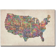
Trademark Global Michael Tompsett "US Cities Text Map VI" Canvas Art, 30" x 47"
Item #: 901-175761TRA
"US Cities Text Map VI" canvas art type
30" x 47"
Michael Tompsett artist
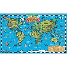
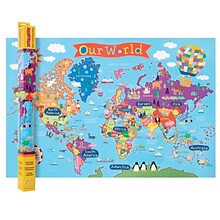
Popar 32" x 54" Kid's World Map Interactive Wall Chart with Free App (RWPWC04)
Item #: 901-24526317
Read-alongs and videos about the ancient world, modern world, and natural wonders
Measures 32" x 54"
Interactive with free app
Ashley Productions Smart Poly 12" x 17" World Basic Map Learning Mat, Double-Sided (ASH95002)
Item #: 901-24529536
Heavy duty double-sided surface, no lamination required
Use with dry erase or water based markers and washable crayons
Water Resistant
Trademark Global Michael Tompsett "Antique World Map" Canvas Art, 16" x 24"
Item #: 901-133624TMG
Antique World Map Canvas Art Type
Michael Tompsett Artist
Giclee is an advanced printmaking process for creating high quality fine art reproductions
Trademark Global Michael Tompsett "Watercolor World Map II" Canvas Art, 30" x 47"
Item #: 901-133659TMG
Watercolor World Map II Canvas Art Type
Michael Tompsett
Unframed
Trademark Global Michael Tompsett "US Cities Text Map III" Canvas Art, 30" x 47"
Item #: 901-175758TRA
US Cities Text Map III canvas art type
Michael Tompsett artist
Material: UV coated, water resistant canvas and wooden bar


