
Page 2 of world u s universal maps
(444 items found)
Sort by:
Best match
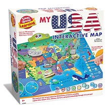
Small World Toys My USA Interactive Map, 30.7" x 24" (SWT9721053)
Item #: 901-24519539
Great learning and educational toy
Interactive talking map
Great way for children to learn the USA map while playing


National Geographic World Decorator Map, Enlarged and Laminated, 73" x 48" (NGMRE00622080)
Item #: 901-24611320
Expertly researched and designed, National Geographic's World Wall Map is the authoritative map of the world by which other reference maps are measured.
Measures 73" x 48"
Colorful Decorator style map with vibrant color palette that fills each country for easy identification


National Geographic National Parks & National Forest of the US, Map Pack Bundle (NGMDM01021301B)
Item #: 901-24611388
National Geographic's Destination Maps of National Forests and Grasslands of the United States highlights the 154 national forests and 20 national grasslands across America.
A list of all forest service and grasslands units, sorted by region, is also included to help you find the closest recreational opportunity.
The National Park and National Forest Map Pack Includes: National Parks of the United States & National Forests and Grasslands of the United States
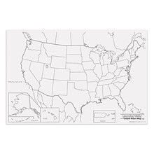
Pacon® Corporation® Learning Walls® US Map (PAC78760)
Item #: 901-JV38297
Subject: Social studies
Subject: Science/technology, nonfiction
Dimensions: 48" x 72"


National Geographic United States Classic Map, Laminated, 43.5" x 30.5" (NGMRE00620411)
Item #: 901-24611428
National Geographic's United States wall map is the standard by which other reference maps of the U.S. are measured
Measures 43.5" x 30.5"
Signature Classic styling with bright, easy to read color palette with blue water and colorful state borders. All 50 states with insets for Hawaiian Islands and Alaska


National Geographic The Dynamic Earth, Plate Tectonics Map, Laminated, 36" x 24" (NGMRE01020634)
Item #: 901-24611386
National Geographic Dynamic Earth, Plate Tectonics Wall Map illustrates plate tectonics & features stunning bathymetry & naturally colored relief, as well as volcano and earthquake data through 2011.
Measures 36" x 24"
The Dynamic Earth map illustrates 17 major tectonic plates and highlights diffuse plate boundaries, convergent boundaries, spreading boundaries, fault zones, hot spots, and more.
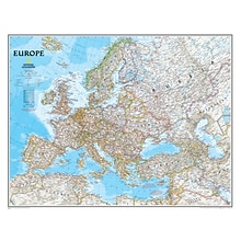
National Geographic Maps Europe Wall Map, 30" x 24"
Item #: 901-JV158525
Subject: Social studies
Subject: Science/technology, nonfiction
Dimensions: 30" x 24"
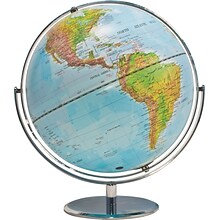
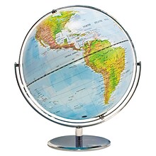
Advantus® 12" Political World Globe, Blue Oceans
Item #: 901-AVT30502
World globe
Each globe has a diameter of 12"
Globe with raised relief and a full swing meridian


AdirOffice Blueprint Maps Expandable Mobile Large Plan Center File Cart, Black (615-BLK)
Item #: 901-2676913
Measuring 51"H x 47"L x 20"D with an adjustable length from 29 to 47 inches, this mobile rack will effectively store your larger files with ease
To provide long-lasting strength and use throughout the years, this mobile blueprint stand is composed of heavy gauge steel with a powder-coated finish
Large file storage rack boasts a 360-pound weight capacity and can hold up to 1800 documents at once
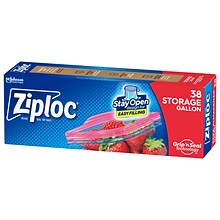
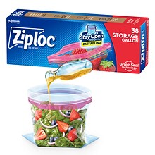
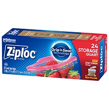
Ziploc Seal Top Storage Bags, Gallon, 38/Box (314470)
Item #: 901-000320
Storing and organizing just about anything: vegetables, fruit, cosmetics, yarn, business cards, maps, and so much more, 1 gallon capacity
38 Bags/Box
Easy Open Tabs for easier accessibility
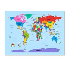
Trademark Fine Art Michael Tompsett 'Childrens World Map' Canvas Art 30x47 Inches
Item #: 901-253024TMG
Nearly Indistinguishable From the Original
Michael Tompsett
30" x 47"
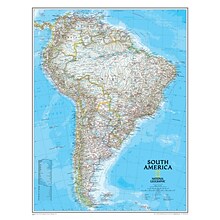
National Geographic Maps South America Wall Map, 24" x 30"
Item #: 901-JV158528
Subject: Social studies
Subject: Science/technology, nonfiction
Classic map of South America shows political boundaries, place-names, airports, major roads and highways, and other geographic features for the entire continent

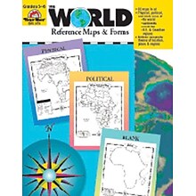
Evan-Moor® The World - Reference Maps & Forms
Item #: 901-JV37097
Age group and grade: Ages 3 - 18 and grades 3rd - 6th
Also includes evaluation forms, crossword puzzle, word search and answer key
Author: Jo Ellen Moore
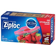
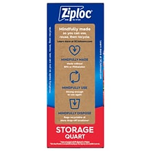
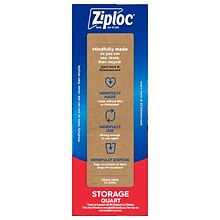
Ziploc Seal Top Storage Bags, Quart, 48/Box (314469)
Item #: 901-00310
Storing and organizing just about anything: vegetables, fruit, cosmetics, yarn, business cards, maps, and so much more, 1 quart capacity
48 Bags/Box
Easy Open Tabs for easier accessibility
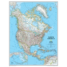
National Geographic Maps North America Wall Map, 24" x 30"
Item #: 901-JV158524
Subject: Social studies
Subject: Science/technology, nonfiction
Dimensions: 24" x 30"
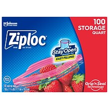
Ziploc Medium Storage Bags, 1 Qt., 100/Box (316962)
Item #: 901-24442307
Storage bag is perfect for storing and organizing just about anything: vegetables, fruit, cosmetics, yarn, business cards, maps, and so much more
Dimensions: 7" x 7.44"
Clear bag is made of durable, long-lasting plastic
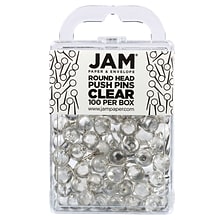
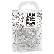
JAM PAPER Round Head Push Pins, Clear, 100/Pack (346RTCL)
Item #: 901-24508595
Plastic Head Thumb Tacks | Color: Clear
Size: Standard (approx. 1 inch) | Steel tipped - perfect for pinning maps and calendars
Quantity: 100 Push Pins | Durable and reusable thumbtacks designed for a long lasting, strong hold
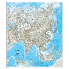
National Geographic Maps® Asia Classic, Laminated
Item #: 901-JV62401
Subject: Social studies
Subject: Science/technology, nonfiction
Dimensions: 34" x 38"
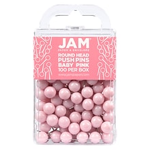
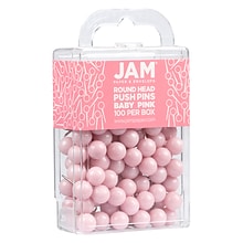
JAM PAPER Round Head Push Pins, Baby Pink Pastel, 100/Pack (346RTBAPI)
Item #: 901-24508368
Plastic Head Thumb Tacks | Color: Light Baby Pink / Light Pink
Size: Standard (approx. 1 inch) | Steel tipped - perfect for pinning maps and calendars
Quantity: 100 Push Pins | Durable and reusable thumbtacks designed for a long lasting, strong hold
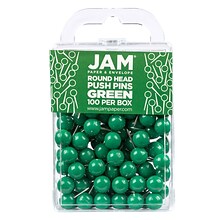
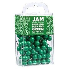
JAM PAPER Round Head Push Pins, Green, 100/Pack (346RTGR)
Item #: 901-24508596
Plastic Head Thumb Tacks | Color: Green
Size: Standard (approx. 1 inch) | Steel tipped - perfect for pinning maps and calendars
Quantity: 100 Push Pins | Durable and reusable thumbtacks designed for a long lasting, strong hold
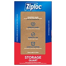
Ziploc Medium Storage Bags, 1 Qt., 24/Carton (314466)
Item #: 901-24442310
Storage bag is perfect for storing and organizing just about anything: vegetables, fruit, cosmetics, yarn, business cards, maps, and so much more
Dimensions: 7" x 7.44"
Clear bag is made of durable, long-lasting plastic

House of Doolittle Laminated World Map, 50" x 33" (HOD710)
Item #: 901-JV158533
Laminated Classroom World Map
Size: 33"(H) x 50"(W)
Material(s): Recycled Paper/Polyethylene
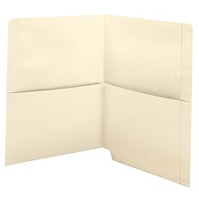
Medical Arts Press End-Tab Folders with Twin 1/2 Pockets, Straight Cut, Letter Size, Manila, 50/Box (31425MAP)
Item #: 901-31425
11 pt
construction
Double-thick end tabs

Medical Arts Press® TAB® Products Compatible Alpha Roll Labels, Letter A
Item #: 901-33300MAP
Each label measures 1"H x 1 1/4"W
Material: Polylaminate
Format: Roll


