
Page 3 of world u s universal maps
(444 items found)
Sort by:
Best match
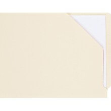
Medical Arts Press File Pocket, Letter Size, Manila, 100/Box (31514MAP)
Item #: 901-31514
End-tab slant file pocket
Each file pocket measures 9 1/2"H x 12 1/4"W overall, 11 3/4" body, 9 1/2" x 12 1/4" jacket
Manila
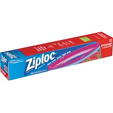
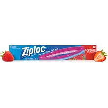
Ziploc Storage Bags, 2 Gal., 12/Carton (314468)
Item #: 901-24419505
2 gal. storage bags are perfect for storing and organizing just about anything: vegetables, fruit, cosmetics, yarn, business cards, maps, and so much more
Dimensions: 13"W x 15"L
Clear bags made of durable, long-lasting plastic

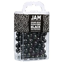
JAM PAPER Round Head Push Pins, Black, 100/Pack (346RTBL)
Item #: 901-24508369
Plastic Head Thumb Tacks | Color: Black
Size: Standard (approx. 1 inch) | Steel tipped - perfect for pinning maps and calendars
Quantity: 100 Push Pins | Durable and reusable thumbtacks designed for a long lasting, strong hold

Medical Arts Press® M and Z Name Labels, Light Green, Smead® Alpha-Z® Compatible
Item #: 901-32212MAP
Each label is printed with 2 letters, just strip away the letter not used
Designed to match Smeadr Alpha-Zr name labels
100 Light Green "M & Z" labels per pack
$10.09
1-3 pack
($0.10/EACH)
Save 5%
$9.59
4+ pack
($0.10/EACH)
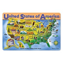

Melissa & Doug® Early Childhood Puzzles, USA Map
Item #: 901-JV37189
Theme/design: U.S.A map
Size: 15.5" x 11.7" x 0.5"
Material: Wood
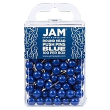
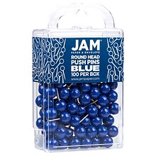
JAM PAPER Round Head Push Pins, Blue, 100/Pack (346RTBU)
Item #: 901-24508367
Plastic Head Thumb Tacks | Color: Blue
Size: Standard (approx. 1 inch) | Steel tipped - perfect for pinning maps and calendars
Quantity: 100 Push Pins | Durable and reusable thumbtacks designed for a long lasting, strong hold
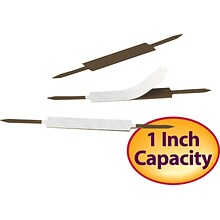
Smead Self-Adhesive Fasteners, 1" Capacity, Brass, 100/Bx (34574)
Item #: 901-34574
A simple way to keep loose documents together in one spot
1" capacity ensures related documents stay together
High-quality folder fasteners are quick and easy to use
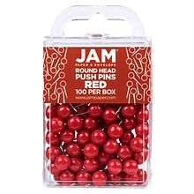
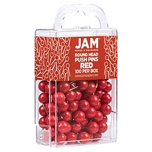
JAM PAPER Round Head Push Pins, Red, 100/Pack (346RTRE)
Item #: 901-24508366
Plastic Head Thumb Tacks | Color: Red
Size: Standard (approx. 1 inch) | Steel tipped - perfect for pinning maps and calendars
Quantity: 100 Push Pins | Durable and reusable thumbtacks designed for a long lasting, strong hold
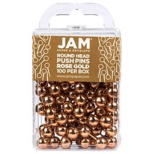
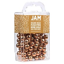
JAM PAPER Round Head Push Pins, Rose Gold, 100/Pack (346RTRSGO)
Item #: 901-24508363
Plastic Head Thumb Tacks | Color: Rose Gold
Size: Standard (approx. 1 inch) | Steel tipped - perfect for pinning maps and calendars
Quantity: 100 Push Pins | Durable and reusable thumbtacks designed for a long lasting, strong hold
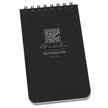
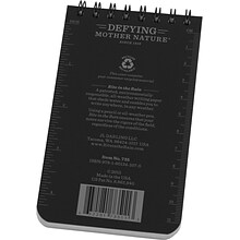
Rite In The Rain All-weather 1-Subject Pocket Notebook, 3" x 5", Graph Ruled, 50 Sheets, Black (735)
Item #: 901-24431255
Notebook great for taking notes
Contains 50 sheets measuring 3" x 5"
Imperial and metric rulers, conversion table, map scale

Medical Arts Press L and Y Name Labels, Smead Alpha-Z Compatible, Lavender, 125/Pack (32211)
Item #: 901-32211MAP
Each label is printed with 2 letters, just strip away the letter not used
Designed to match Smead Alpha-Z name labels
100 Pink "L & Y" labels per pack
$9.69
1-3 pack
($0.10/EACH)
Save 5%
$9.19
4+ pack
($0.09/EACH)
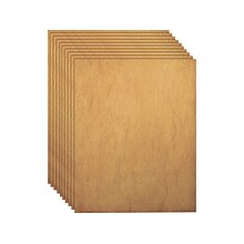
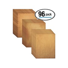
Better Office Design/Craft Paper, 8.5" x 11", Parchment, 96/Pack (64501)
Item #: 901-24445397
Design paper is great for poetry scrolls, scrapbooks, scavenger hunt maps, invitations, annual Christmas or holiday letters, and more
Comes in light-to-medium parchment colors (32 sheets each) that are light enough to accommodate black pen, marker, or ink jet/laser jet printing
Paper weight: 27 lbs.
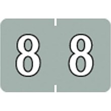
Medical Arts Press® Barkley® & Sycom® Compatible Numeric Roll Labels, "8"
Item #: 901-34155Q
Use with Any End Tab Filing System
All Scored, Self-Adhesive Labels Are Laminated To Prevent Smudging and Cracking
500 Identical Roll Style Labels/Box
$19.09
1-3 roll
($0.04/EACH)
Save 1%
$18.99
4+ roll
($0.04/EACH)
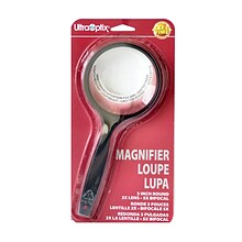
Ultraoptix Magnifier 3 In. (SV-3P)
Item #: 901-2135335ASN
Shatter proof and scratch resistant
For reading small print, contracts, telephone directories, stock listings, maps, charts, stamps, and coins
2 in. round magnifier has 3X power lens, no bifocal
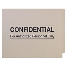
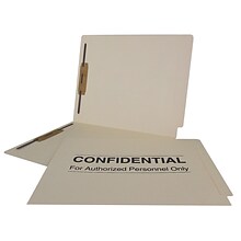
Medical Arts Press Confidential End-Tab Folders; 14 Point, 2 Fasteners, 50/Box (52319)
Item #: 901-52319
Confidential end-tab folder
Each label measures 9 1/2"H x 12 1/4"W overall, 11 3/4"W body
Manila
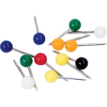
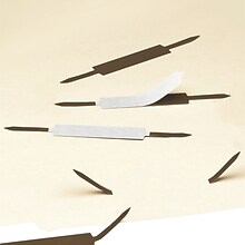
Advantus Gem Map Tacks, Assorted, 100/Pack (MTA)
Item #: 901-GEMMTAUNI
100 tacks per box
Made in U.S.A.
Material: Steel pin, plastic head


National Geographic United States for Kids Map, Laminated, 24" x 36" (NGMRE01021159)
Item #: 901-24611434
Expertly researched and designed, National Geographic's The United States for Kids wall map is an enticing and engaging United States map perfect for classroom, home or library.
Measures 24" x 36"
Recommended by geography educators for ages 7–12, this map features an optimized map design for readability and easy, intuitive learning.
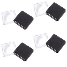
Carson Gn-33 Magniflip 1.5" Flip-open Pocket Magnifier With Built-in Case, 4 Pack
Item #: 901-24005741
Magnifier, used for reading labels at the grocery store or even reading maps while on the road.
DIM: 1.75" x 1.75" x 2"
3x magnification


Post-it Super Sticky Easel Pad, 25" x 30", Grid Lined, 30 Sheets/Pad, 2 Pads/Carton (560)
Item #: 901-560QQ
STICKS SECURELY AND HOLDS UP TO 2X LONGER - Easel paper can be repositioned without surface damage. No tape or tacks needed unlike standard flip chart paper. Keep agenda and ideas where everyone can see
INK BLEED-THROUGH RESISTANT PAPER - Large white grid lined premium self-stick flip chart paper that resists marker bleed-through to keep great ideas on the page, not on what's under the page
IDEAL FOR MAPPING PROCESSES AND CHARTS - Perfect for training or teaching sessions, brainstorming sessions, planning sessions, project management and agile processes, meetings and presentations
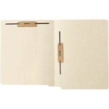
Medical Arts Press Extra Heavy-Duty Reinforced End-Tab File Folders, 2-Fasteners, Letter, Manila, 50/Bx (52473)
Item #: 901-52473
18-Pt. Extra-Heavy-Duty Manila Stock with Mylar-Reinforced Spines for Added Strength
Embossed Score Lines for Even Positioning Of Color-Coded Labels
Scored for 0.75-Inch Expansion
$75.59
1-4 box
($1.51/EACH)
Save 6%
$70.99
5+ box
($1.42/EACH)
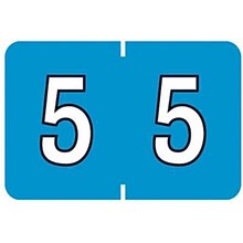
Medical Arts Press® Barkley® & Sycom® Compatible Numeric Roll Labels, "5"
Item #: 901-34152Q
Use with Any End Tab Filing System
All Scored, Self Adhesive Labels Are Laminated To Prevent Smudging And Cracking
500 Identical Roll Style Labels/Box

Medical Arts Press® Jeter® Compatible Alpha Sheet Style Labels, "U"
Item #: 901-33591Q
Compatible with Jeterr 7100, 7200 & 5800 Series Labels
Use with Any End-Tab Filing System
All Scored, Self-Adhesive Labels Are Laminated to Prevent Cracking
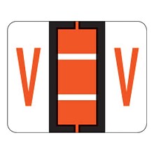
Medical Arts Press® TAB® Products Compatible Alpha Sheet Style Labels; Letter V
Item #: 901-33822MAP
126 Dark Orange "V" labels per pack (14 sheets, 9 labels each)
Size: 1-1/4"W x 1"H before folding
Compatible with TABr Products labels - same design, same color - but you pay less! Labels are scored and self-adhesive with clear laminate finish
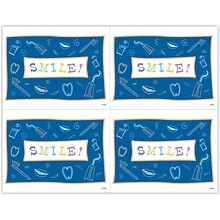
Graphic Image Laser Postcards, Dental Icons
Item #: 901-675610
Occasion: Recall
MAP® Brand Graphic Image Laser Postcards Dental Iconscome in packs of 100 postacrds for easy mailing. Available in a variety of colors and patterns for use on laser printers. Laser postcards let you personalize each message for convenience.
Laser postcard sheets give you four full-color designs on every 8-1/2x11" laser postcard sheet


