Page 3 of maps globes atlases school products
(168 items found)
Sort by:
Best match


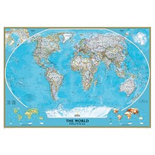
National Geographic World Physical Map, Laminated, 45.75" x 30.5" (NGMRE00620132)
Item #: 901-24611413
Expertly researched and designed, National Geographic's The Physical World map highlights the Earth's land and undersea forms with exquisite hand-painted relief.
Two corner inset maps show the Earth's crust and world climatic zones.
Drawn in the Winkel Tripel projection, distortions are minimized and unlike many other World maps, Greenland is show the same size as Argentina and not as the size of all of South America.
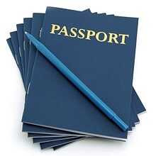
Hygloss™ My Passport Book, 24/Pack
Item #: 901-JV51490
Title: Passport
Subject: Science/technology, nonfiction
Dimensions: 4 1/4" x 5 1/2"
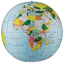
Replogle Globe Political Inflate-A-Globe, Light Blue, 12", 2/Bundle
Item #: 901-883184
Style: Political
Size: 12"(Dia)
Introduce children to geography with this inflatable globe, available in a variety of sizes and styles, each globe is brilliantly colored and extremely durable


Teacher Created Resources Die-Cut Border, 2.75" x 210', Travel the Map Globes (TCR8640-6)
Item #: 901-24501092
Die-Cut Border
2.75" x 210'
Travel the Map Globes
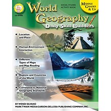
Mark Twain World Geography Resource Book, Middle Grades & Up
Item #: 901-805486OSA
Middle Grades & Up
Covers location and place, human-environment interaction, different types of maps, and map reading, as well as the regions and countries of the world
Perfect for review and practice

Hygloss Grade Infant - 12 Globes Bright Classroom Border, Blue, 12/Pack
Item #: 901-JV156988
Globes classroom borders for infant - 12th grades to help students learn about geography
36' long border can be split up and used separately in areas with good visibility
Dimensions: 36"L x 3"W each


National Geographic World Executive Map, Laminated, 46" x 30.5" (NGMRE00622087)
Item #: 901-24611366
Expertly researched and designed, National Geographic's World Wall Map is the authoritative map of the world by which other reference maps are measured.
Measures 46" x 30.5"
Antique-style "executive" color palette
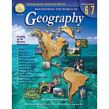
Mark Twain Discovering the World of Geography Resource Book, Grades 6 - 7
Item #: 901-830882OSA
Grades 6 - 7
Information is presented through activities such as maps, charts, diagrams, and graphs
Based on National Geography standards


National Geographic World and United States Executive, Poster Size, Map Pack Bundle, 36" x 24" (NGMRE01021232B)
Item #: 901-24611443
National Geographic's World and United States maps are the standard by which all other reference maps are measured.
Measures 36" x 24"
Antique-style "executive" color palette


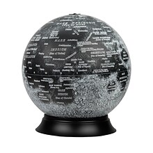
National Geographic Earth's Moon Map, Laminated, 42.5" x 28.5" (NGMRE00620137)
Item #: 901-24611437
National Geographic's "The Earth's Moon" is like having an atlas and almanac in one.
This incredibly informative wall map features detailed depictions of the entire surface of the moon with a selective index showing the named physical features.
Diagrams show the moon's orbital paths, rotation around Earth, librations, how solar and lunar eclipses occur, how the moon affects Earth's tides, and more.


National Geographic World and United States Classic, Poster Size, Map Pack Bundle, 36" x 24" (NGMRE01021231B)
Item #: 901-24611427
National Geographic's World and United States maps are the standard by which all other reference maps are measured.
Measures 36" x 24"
The signature Classic style maps use a bright, easy to read color palette featuring blue oceans and stunning shaded relief that has been featured on National Geographic wall maps for over 75 years.
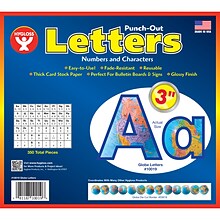
Hygloss Products 3" Punch-Out Letters, Globes (HYG10019)
Item #: 901-JV2127315
Letters/Decoration
Assorted Colors
10.5" x 9" x .5"
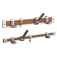
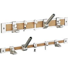
Ghent® Maprail Flag Holder, 1", 2 EA/BD
Item #: 901-877757
Add lots of capability to the rail
Grades: All
Age: All
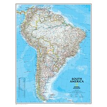
National Geographic Maps South America Wall Map, 24" x 30"
Item #: 901-JV158528
Subject: Social studies
Subject: Science/technology, nonfiction
Classic map of South America shows political boundaries, place-names, airports, major roads and highways, and other geographic features for the entire continent
National Geographic Illuminated Moon Globe, 12" Diameter (RE-83522)
Item #: 901-24439128
Illuminated Moon Globe
Globe Size: 12" Diameter
Material: Vinyl, Plastic


National Geographic World Decorator Map, Laminated, 46" x 30.5" (NGMRE00622079)
Item #: 901-24611317
Expertly researched and designed, National Geographic's World Wall Map is the authoritative map of the world by which other reference maps are measured.
Measures 46" x 30.5"
Colorful Decorator style map with vibrant color palette that fills each country for easy identification
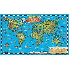
Popar 32" x 54" Kid's World Map Interactive Wall Chart with Free App (RWPWC04)
Item #: 901-24526317
Read-alongs and videos about the ancient world, modern world, and natural wonders
Measures 32" x 54"
Interactive with free app


National Geographic The Heavens Map, Laminated, 30.5" x 22.75" (NGMRE00620136)
Item #: 901-24611415
National Geographic's The Heavens shows star charts and constellations for both the Northern and Southern Hemispheres.
All 2,844 of the stars on the chart, plus nebulae and star clusters, can be seen with the unaided eye, making this chart a perfect companion for viewing the night sky.
They inspire great works of art, and tempt our imaginations into creating stories and myths from the shapes we see.
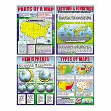
McDonald Publishing, Basic Map Skills Teaching Poster Set 22" x 17.5", 9/set (MC-P222)
Item #: 901-JV23998989
Map Skills
22" x 17.5"
Age 9-14
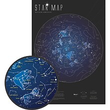
Maps International 33" x 23" Glow in the Dark Star Map (RWPMI03)
Item #: 901-24526461
Map glows in the dark
Measures 33" x 23"
Great way for students to learn the stars and constellation patterns
National Geographic World Classic Wall Map, Mural, 110" x 76.5" (NGMRE00622007)
Item #: 901-JV62402
Mural World Map
Size(s): 110" x 76.5"
Material(s): Laminated Paper


National Geographic World Classic Map, Enlarged and Laminated, 69.25" x 48" (NGMRE00622003)
Item #: 901-24611409
Expertly researched and designed, National Geographic's World Wall Map is the authoritative map of the world by which other reference maps are measured.
Measures 69.25" x 48"
Signature Classic style map with bright, easy to read color palette with blue oceans and colorful borders
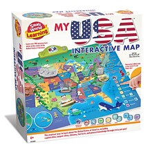
Small World Toys My USA Interactive Map, 30.7" x 24" (SWT9721053)
Item #: 901-24519539
Great learning and educational toy
Interactive talking map
Great way for children to learn the USA map while playing


National Geographic World Executive Map, Mural, 110" x 76.5" (NGMRE00620092)
Item #: 901-24611398
National Geographic World Wall Map Executive is expertly researched and designed, National Geographic's World Wall Map is the authoritative map of the world by which other reference maps are measured.
Antique-style "executive" color palette
Thousands of place names carefully and artfully placed to maintain legibility in heavily populated areas


