
Page 4 of maps globes atlases school products
(168 items found)
Sort by:
Best match
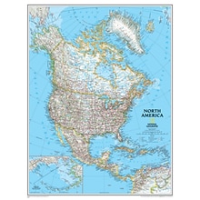
National Geographic Maps North America Wall Map, 24" x 30"
Item #: 901-JV158524
Subject: Social studies
Subject: Science/technology, nonfiction
Dimensions: 24" x 30"
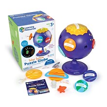

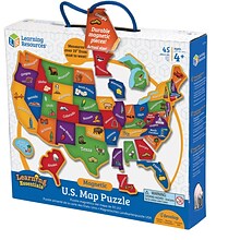
Learning Resources Solar System Puzzle Globe (LER3320)
Item #: 901-24544844
Hold the mysteries of the solar system in the palms of your hands with this puzzle globe
For ages 3 to 10
Teaches kids early astronomy and develops fine motor skills


Supertek Celestial Globe with Meridian Ring (SKFB19018T)
Item #: 901-24610043
Enjoy learning about the universe using this high-quality hands-on Globe
Grade 3+
Define star activity to the students


National Geographic World Classic Map, Poster Size and Laminated, 36" x 24" (NGMRE01020381)
Item #: 901-24611380
Expertly researched and designed, National Geographic's World Wall Map is the authoritative map of the world by which other reference maps are measured.
The 36" x 24" poster size supports easy and affordable framing and mounting, and takes less wall space than standard wall maps.
Signature Classic style map with bright, easy to read color palette with blue oceans and colorful borders

National Geographic Australia Classic Map, Laminated, 30.25" x 27" (NGMRE00620146)
Item #: 901-24611407
Expertly researched and designed, National Geographic's Australia Wall Map is the authoritative map of Asia by which other reference maps are measured.
Signature Classic style map with bright, easy to read color palette with blue oceans and colorful borders
Clearly defined international boundaries, cities, islands, airports, and physical features


National Geographic World Executive Map, Enlarged and Laminated, 73" x 48" (NGMRE00622088)
Item #: 901-24611311
Expertly researched and designed, National Geographic's World Wall Map is the authoritative map of the world by which other reference maps are measured.
Measures 73" x 48"
Antique-style "executive" color palette


National Geographic World Executive Map, Poster Size and Laminated, 36" x 24" (NGMRE01020376)
Item #: 901-24611378
Expertly researched and designed, National Geographic's World Wall Map is the authoritative map of the world by which other reference maps are measured.
The 36" x 24" poster size supports easy and affordable framing and mounting, and takes less wall space than standard wall maps.
Antique-style "executive" color palette

National Geographic Antarctica Satellite Map, Laminated, 31.25" x 20.25" (NGMRE00620144)
Item #: 901-24611405
National Geographic Antarctica Satellite Wall Map has a striking view of Antarctica's terrain, compiled from 4,500 satellite scans
Additional inset maps show surface elevation, ice sheet thickness, velocity of ice flow, and sea ice movement and windflow.
The map is encapsulated in heavy-duty 1.6 mil laminate which makes the paper much more durable and resistant to the swelling and shrinking caused by changes in humidity.


National Geographic The Dynamic Earth, Plate Tectonics Map, Laminated, 36" x 24" (NGMRE01020634)
Item #: 901-24611386
National Geographic Dynamic Earth, Plate Tectonics Wall Map illustrates plate tectonics & features stunning bathymetry & naturally colored relief, as well as volcano and earthquake data through 2011.
Measures 36" x 24"
The Dynamic Earth map illustrates 17 major tectonic plates and highlights diffuse plate boundaries, convergent boundaries, spreading boundaries, fault zones, hot spots, and more.


National Geographic Night Sky, Stargazer folded Map Pack Bundle, Folded: 4.25" x 9.25" ; Flat: 25.25" x 18.5" (NGMRE01021310B)
Item #: 901-24611374
National Geographic's The Night Sky - Stargazer Map Pack the Northern Hemisphere is centered on Polaris, the North Star, the Southern Hemisphere is centered near Crux, the Southern Cross.
Measures 4.25" x 9.25" folded and 25.25" x 18.5" flat
As the Earth moves in its orbit around the Sun the constellations in the sky change. The Night Sky maps include four seasonal charts that are specific for each season.


National Geographic World Decorator Map, Enlarged and Laminated, 73" x 48" (NGMRE00622080)
Item #: 901-24611320
Expertly researched and designed, National Geographic's World Wall Map is the authoritative map of the world by which other reference maps are measured.
Measures 73" x 48"
Colorful Decorator style map with vibrant color palette that fills each country for easy identification
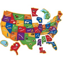
Ashley Productions Smart Poly™ Learning Mats, 12" x 17", Double-Sided, U.S. Basic Map, Pack of 10 (ASH95600)
Item #: 901-24389608
Water Resistant
Colorful designs on both sides
Measures 12" x 17", pack of 10 learning mats
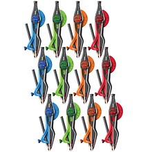
Helix Universal Locking Compass, Math, Grade 5+ (MAP37280-12)
Item #: 901-24493878
Universal Locking Compass
Grade 5+
12" Diameter
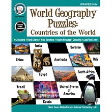
Mark Twain World Geography Puzzles: Countries Of The World, Grades 5 - 12 Paperback (405015)
Item #: 901-24298863
Mark Twain Media 2018
Mark Twain Media
48 pages in paperback format


National Geographic Road Atlas 2024: Adventure Edition, United States, Canada, Mexico, 11" x 15" (NGMRD00620166)
Item #: 901-24611369
National Geographic's Road Atlas: Adventure Edition, is the ideal companion for the next time you hit the road.
Setting this atlas apart from all other road atlases are the inclusion of detailed maps and guidebook-like recommendations on the top 100 destinations for adventure.
Includes up-to-date road maps for all 50 U.S. States, plus Canada, Mexico, and Puerto Rico. Major cities and metropolitan areas are shown in detail with inset maps that include popular attractions.
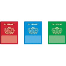
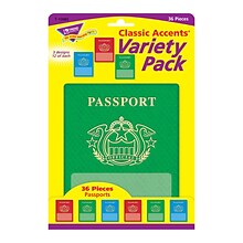
Passports Classic Accents® Variety Pack
Item #: 901-JV59873
Age group and grade: Ages 3 - 15 and grades pre - kindergarten - 9th
Theme: Passports
Add a sense of fun and wonder to every lesson
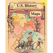
Mark Twain U.S. History Maps Resource Book
Item #: 901-830284OSA
Grades 5 - 8+
Features maps designed to be easily reproduced, projected, or scanned
Includes a variety of classroom activities and brief explanations of historical events


National Geographic The Milky Way Map, Laminated, 31.25" x 20.25" (NGMRE00620140)
Item #: 901-24611410
This computer-generated image of the Milky Way shows the entire galaxy in one perspective of a 3-D model compiled specially for National Geographic.
The model incorporates the positions of hundreds of thousands of stars and nebulae within the galaxy, shows Earth's location.
Includes additional photographs, descriptions and locations of fascinating phenomena throughout the Milky Way.


Carson Dellosa Education Scalloped Border, 3"x 3', Let's Explore World Map, 6/Bundle (CD-108481-6)
Item #: 901-24642930
Add excitement to your learning environment with this reusable border
Product Dimension: 3" x 36" strips
The stunning bulletin border features all of the continents of the world in nostalgic colors to add a touch of adventure to your learning displays, wall decor, classroom borders, and more.


National Geographic United States Decorator Map, Laminated, 43.5" x 30.5" (NGMRE00622083)
Item #: 901-24611382
National Geographic's Decorator style map of the United States features rich, attractive color fills that bring any room or classroom to life.
Measures 43.5" x 30.5"
Colorful Decorator style map with vibrant color palette that fills each country for easy identification
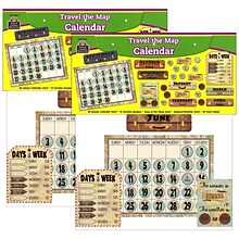
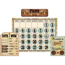
Teacher Created Resources Travel the Map Calendar Bulletin Board Set, 2 Sets (TCR8567-2)
Item #: 901-24509524
Bulletin Board Set
Measures 24" x 18"
Multicolored Paper


National Geographic United States Decorator Map, Enlarged and Laminated, 43.5" x 30.5" (NGMRE00622084)
Item #: 901-24611365
National Geographic's Decorator style map of the United States features rich, attractive color fills that bring any room or classroom to life.
Measures 43.5" x 30.5"
Colorful Decorator style map with vibrant color palette that fills each country for easy identification
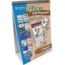
NewPath Learning 18"H x 12"W Curriculum Mastery Learning Flip Chart Set, Earth Science (NP-346008)
Item #: 901-JV35948
Curriculum Mastery Flip Chart
Subject: Earth science
Size: 18"H x 12"W


